
Fichier:A new and correct map of the whole world, shewing ye situation of its principal parts. ... according to the newest and most exact observations - by Herman Moll, geographer, 1719. NYPL1630430.tiff

Taille de cet aperçu JPG pour ce fichier TIF : 800 × 455 pixels. Autres résolutions : 320 × 182 pixels | 640 × 364 pixels | 1 024 × 582 pixels | 1 280 × 727 pixels | 2 560 × 1 455 pixels | 9 519 × 5 409 pixels.
Fichier d’origine (9 519 × 5 409 pixels, taille du fichier : 147,34 Mio, type MIME : image/tiff)
Ce fichier et sa description proviennent de Wikimedia Commons.
Description
| Description |
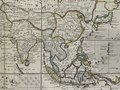
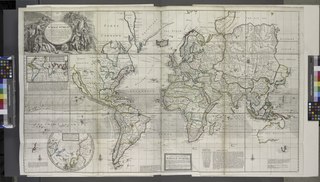
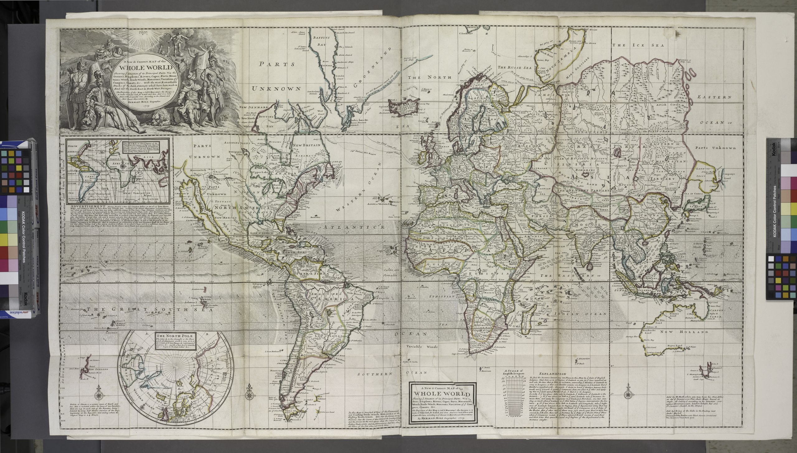
English: Title: A New and Correct Map of the Whole World: Shewing ye Situation of its Principal Parts, Viz the Oceans, Kingdoms, Rivers, Capes, Ports, Mountains, Woods, Trade Winds, Monsoons, Variation of ye Compass, Climats, &c. with the most Remarkable Tracks of the Bold Attempts which have been made to Find out the North East & North West Passages. The Projection of this Map is Call'd Mercator's the Design is to make it Useful both for Land and Sea. And it is laid Down with all possible Care, According to the Newest and Most Exact Observations By Herman Moll Geographer. 1719. |
|||||||||||||||||||||||
| Notes | To His most sacred Majesty George II, ... King of Great Britain, France and Ireland ... this map is humbly dedicated. | |||||||||||||||||||||||
| Catalogue call number | Map Div. 97-6053[LHS 329; atlas cases] | |||||||||||||||||||||||
| Item/Page/Plate | 2 | |||||||||||||||||||||||
| Standard reference | Variant of Phillips 554 | |||||||||||||||||||||||
| Date | ||||||||||||||||||||||||
| Source |
The World Described, or, A New and Correct Sett of Maps: Shewing the Kingdoms and States in All the Known Parts of the Earth with the Principal Cities and Most Considerable Towns in the World
|
|||||||||||||||||||||||
| Auteur |
Herman Moll (d. 1732), cartographer and author |
|||||||||||||||||||||||
| Autorisation (Réutilisation de ce fichier) |
From The Lionel Pincus and Princess Firyal Map Division. http://maps.nypl.org
|
|||||||||||||||||||||||
| Autres versions |
|
|||||||||||||||||||||||
| Source description | 1 atlas (65 leaves (most folded)) : 31 maps (most hand col.) ; 65 cm. | |||||||||||||||||||||||
| Location | Stephen A. Schwarzman Building / The Lionel Pincus and Princess Firyal Map Division | |||||||||||||||||||||||
| Digital item published | 5-12-2008; updated 1-9-2012 | |||||||||||||||||||||||
| Digital ID | 1630430 | |||||||||||||||||||||||

The making of this file was supported by Wikimedia UK.
To see other files made with the support of Wikimedia UK, please see the category Supported by Wikimedia UK.
|
Historique du fichier
Cliquer sur une date et heure pour voir le fichier tel qu'il était à ce moment-là.
| Date et heure | Vignette | Dimensions | Utilisateur | Commentaire | |
|---|---|---|---|---|---|
| actuel | 20 avril 2014 à 22:39 | 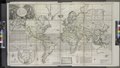 | 9 519 × 5 409 (147,34 Mio) | Fæ | GWToolset:: Creating mediafile for Fæ. Tranche 2.1206 |
Utilisation du fichier
La page suivante utilise ce fichier :