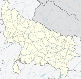
Etawah
| Etawah | |||||
 Fort Sumer Singh | |||||
| Administration | |||||
|---|---|---|---|---|---|
| Pays | |||||
| État ou territoire | Uttar Pradesh | ||||
| District | District de Etawah | ||||
| Index postal | 206001 | ||||
| Fuseau horaire | IST (UTC+05:30) | ||||
| Indicatif | 5688 | ||||
| Démographie | |||||
| Population | 256 790 hab. (2011[1]) | ||||
| Géographie | |||||
| Coordonnées | 26° 46′ nord, 79° 02′ est | ||||
| Altitude | Max. 197 m | ||||
| Localisation | |||||
| Géolocalisation sur la carte : Inde
Géolocalisation sur la carte : Inde
Géolocalisation sur la carte : Uttar Pradesh
Géolocalisation sur la carte : Uttar Pradesh
| |||||
| Liens | |||||
| Site web | Etawah | ||||
| modifier |
|||||
Etawah (en hindi : इटावा) est une ville au bord de la rivière Yamunâ est appartenant à l'État de l'Uttar Pradesh en Inde.
Géographie[modifier | modifier le code]
Économie[modifier | modifier le code]
Histoire[modifier | modifier le code]
Références[modifier | modifier le code]
- [PDF] « Provisional Population Totals, Census of India 2011; Urban Agglomerations/Cities having population 1 lakh and above », Office of the Registrar General & Census Commissioner, India (consulté le )


