
Fichier:Suez Canal, Port Said - ISS 2.jpg

Taille de cet aperçu : 800 × 585 pixels. Autres résolutions : 320 × 234 pixels | 640 × 468 pixels | 1 024 × 749 pixels | 1 280 × 937 pixels | 2 744 × 2 008 pixels.
Fichier d’origine (2 744 × 2 008 pixels, taille du fichier : 2,54 Mio, type MIME : image/jpeg)
Ce fichier et sa description proviennent de Wikimedia Commons.
Description
| Description |
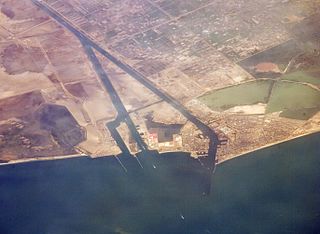
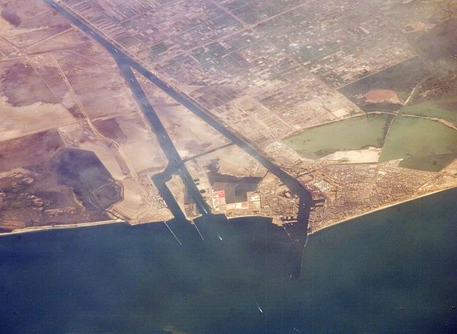
English: Port Said and the entrance to the Suez Canal. Photographed from the International Space Station.
|
| Date | |
| Source | http://eol.jsc.nasa.gov/SearchPhotos/photo.pl?mission=ISS013&roll=E&frame=44847 |
| Auteur | NASA astronaut |
| Autres versions |

Journal des téléversements d’origine
Gebruiker Ajoman, 10 aug 2006 20:55 1.000x750, description:Monding Suez kanaal. Afkomstig van NASA. June 30, 2006, source: suez)
Conditions d’utilisation
"The Gateway to Astronaut Photography of Earth". Image provenant du Laboratoire d'Analyse et d'Imagerie des Sciences, Centre Spatial Johnson de la NASA.
Source de la photo : ISS013-E-44847.
|
Historique du fichier
Cliquer sur une date et heure pour voir le fichier tel qu'il était à ce moment-là.
| Date et heure | Vignette | Dimensions | Utilisateur | Commentaire | |
|---|---|---|---|---|---|
| actuel | 13 juillet 2016 à 17:19 | | 2 744 × 2 008 (2,54 Mio) | Ras67 | new rendered from NASA's raw image data in high quality |
| 26 juillet 2008 à 13:39 |  | 1 000 × 750 (287 kio) | Dryke | {{Information |Description=Port Said and the entrance to the Suez Canal. Photographed from the International Space Station. |Source={{AstronautPhoto|mission=ISS013|roll=E|frame=44847}} |Date=30 June 2006 |Author=unnamed N |
Utilisation du fichier
Les 2 pages suivantes utilisent ce fichier :
Usage global du fichier
Les autres wikis suivants utilisent ce fichier :
- Utilisation sur ar.wikipedia.org
- Utilisation sur ast.wikipedia.org
- Utilisation sur ceb.wikipedia.org
- Utilisation sur de.wikipedia.org
- Utilisation sur el.wikipedia.org
- Utilisation sur en.wikipedia.org
- Utilisation sur en.wikivoyage.org
- Utilisation sur es.wikipedia.org
- Utilisation sur eu.wikipedia.org
- Utilisation sur fa.wikipedia.org
- Utilisation sur he.wikipedia.org
- Utilisation sur hu.wikipedia.org
- Utilisation sur ja.wikipedia.org
- Utilisation sur ja.wikivoyage.org
- Utilisation sur ko.wikipedia.org
- Utilisation sur mt.wikipedia.org
- Utilisation sur ne.wikipedia.org
- Utilisation sur nl.wikipedia.org
- Utilisation sur nn.wikipedia.org
- Utilisation sur pl.wikipedia.org
- Utilisation sur pnb.wikipedia.org
- Utilisation sur pt.wikipedia.org
- Utilisation sur sh.wikipedia.org
- Utilisation sur sr.wikipedia.org
- Utilisation sur sv.wikipedia.org
- Utilisation sur uk.wikivoyage.org
- Utilisation sur ur.wikipedia.org