
Fichier:Rottnest aerial photo 2.jpg

Taille de cet aperçu : 800 × 600 pixels. Autres résolutions : 320 × 240 pixels | 640 × 480 pixels | 1 024 × 768 pixels | 1 280 × 960 pixels | 2 560 × 1 920 pixels.
Fichier d’origine (2 560 × 1 920 pixels, taille du fichier : 5,29 Mio, type MIME : image/jpeg)
Ce fichier et sa description proviennent de Wikimedia Commons.
| Description |
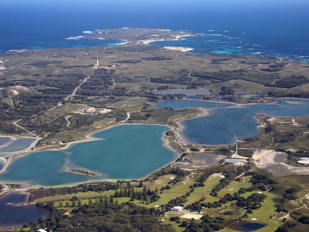
English: Aerial photograph of central Rottnest Island, photographed from above the Thomson Bay settlement, looking west towards Cape Vlamingh. Visible in the foreground are the golf course, wind turbine, Mt Herschell and some salt lakes. |
| Date | |
| Source | Travail personnel |
| Auteur | Mark |
| Autres versions |
.jpg)
Conditions d’utilisation
Moi, en tant que détenteur des droits d’auteur sur cette œuvre, je la publie sous la licence suivante :

|
Vous avez la permission de copier, distribuer et modifier ce document selon les termes de la GNU Free Documentation License version 1.2 ou toute version ultérieure publiée par la Free Software Foundation, sans sections inaltérables, sans texte de première page de couverture et sans texte de dernière page de couverture. Un exemplaire de la licence est inclus dans la section intitulée GNU Free Documentation License. |
Historique du fichier
Cliquer sur une date et heure pour voir le fichier tel qu'il était à ce moment-là.
| Date et heure | Vignette | Dimensions | Utilisateur | Commentaire | |
|---|---|---|---|---|---|
| actuel | 11 août 2008 à 13:35 | | 2 560 × 1 920 (5,29 Mio) | Mark | {{Information |Description={{en|1=Aerial photograph of central Rottnest Island, photographed from above the Thomson Bay settlement, looking west towards Cape Vlamingh. Visible in the foreground are the golf course, wind turbine, Mt H |
Utilisation du fichier
La page suivante utilise ce fichier :
Usage global du fichier
Les autres wikis suivants utilisent ce fichier :
- Utilisation sur de.wikipedia.org
- Utilisation sur en.wikipedia.org
- Utilisation sur gl.wikipedia.org
- Utilisation sur incubator.wikimedia.org
- Utilisation sur nl.wikipedia.org