
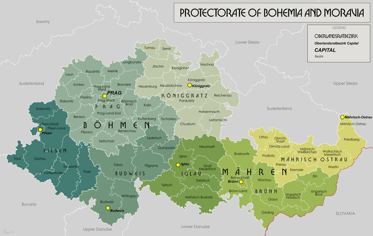
Fichier:Protectorate Of Bohemia and Moravia.png

Taille de cet aperçu : 800 × 506 pixels. Autres résolutions : 320 × 202 pixels | 640 × 404 pixels | 1 024 × 647 pixels | 1 280 × 809 pixels | 3 000 × 1 896 pixels.
Fichier d’origine (3 000 × 1 896 pixels, taille du fichier : 1,21 Mio, type MIME : image/png)
Ce fichier et sa description proviennent de Wikimedia Commons.

|
Cette image (de type locator map) devrait être recréée dans un format vectoriel, en tant que fichier SVG. Cela offrirait plusieurs avantages : voir Commons:Media for cleanup pour plus d'informations. Si une version SVG de cette image est déjà disponible, merci de bien vouloir l'envoyer. Après cela, remplacez ce modèle par {{vector version available|nouveau nom d'image.svg}}.
|
Description
| Description |
English: English version of File:Protektorat_Bohmen-Mahren.png |
| Date | |
| Source | Travail personnel |
| Auteur | XrysD |
Conditions d’utilisation
Moi, en tant que détenteur des droits d’auteur sur cette œuvre, je la publie sous la licence suivante :
Ce fichier est disponible selon les termes de la licence Creative Commons Attribution – Partage dans les Mêmes Conditions 3.0 (non transposée).
- Vous êtes libre :
- de partager – de copier, distribuer et transmettre cette œuvre
- d’adapter – de modifier cette œuvre
- Sous les conditions suivantes :
- paternité – Vous devez donner les informations appropriées concernant l'auteur, fournir un lien vers la licence et indiquer si des modifications ont été faites. Vous pouvez faire cela par tout moyen raisonnable, mais en aucune façon suggérant que l’auteur vous soutient ou approuve l’utilisation que vous en faites.
- partage à l’identique – Si vous modifiez, transformez, ou vous basez sur cette œuvre, vous devez distribuer votre contribution sous la même licence ou une licence compatible avec celle de l’original.
Historique du fichier
Cliquer sur une date et heure pour voir le fichier tel qu'il était à ce moment-là.
| Date et heure | Vignette | Dimensions | Utilisateur | Commentaire | |
|---|---|---|---|---|---|
| actuel | 21 janvier 2020 à 19:38 | | 3 000 × 1 896 (1,21 Mio) | XrysD | Typo: Güding-->Göding |
| 28 mai 2018 à 17:24 |  | 3 000 × 1 896 (1,29 Mio) | XrysD | Typo Iglaü-->Iglau | |
| 11 mars 2014 à 17:28 |  | 3 000 × 1 896 (1,22 Mio) | XrysD | Line thickness increased and some labels darkened to improve clarity and legibility. | |
| 3 mars 2014 à 18:54 |  | 3 000 × 1 896 (1,15 Mio) | XrysD | Completely new version of map. New data digitised from Karte des Deutschen Reiches 1:100 000. | |
| 27 mai 2012 à 21:52 |  | 1 588 × 1 066 (1,04 Mio) | XrysD |
Utilisation du fichier
Aucune page n’utilise ce fichier.
Usage global du fichier
Les autres wikis suivants utilisent ce fichier :
- Utilisation sur ar.wikipedia.org
- Utilisation sur azb.wikipedia.org
- Utilisation sur bs.wikipedia.org
- Utilisation sur de.wikipedia.org
- Utilisation sur de.wikiversity.org
- Utilisation sur en.wikipedia.org
- Utilisation sur et.wikipedia.org
- Utilisation sur ja.wikipedia.org
- Utilisation sur ko.wikipedia.org
- Utilisation sur mk.wikipedia.org
- Utilisation sur pt.wikipedia.org
- Utilisation sur sh.wikipedia.org
- Utilisation sur sr.wikipedia.org
- Utilisation sur uk.wikipedia.org
- Utilisation sur vi.wikipedia.org
- Utilisation sur zh.wikipedia.org