
Fichier:Plan du Louvre médiéval.jpg

Taille de cet aperçu : 800 × 600 pixels. Autres résolutions : 320 × 240 pixels | 640 × 480 pixels | 1 024 × 768 pixels | 1 280 × 960 pixels | 2 560 × 1 920 pixels | 2 816 × 2 112 pixels.
Fichier d’origine (2 816 × 2 112 pixels, taille du fichier : 1,45 Mio, type MIME : image/jpeg)
Ce fichier et sa description proviennent de Wikimedia Commons.
Description
| Description |
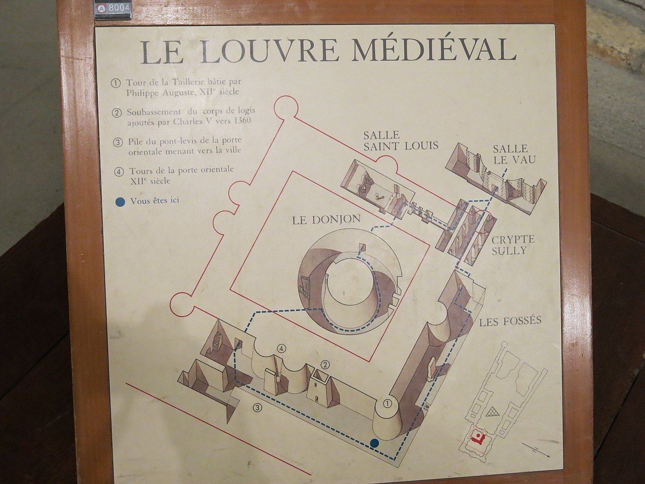
English: Map of the medieval Louvre (Paris, France). The Seine river are at the top and the left, on the side of the wall in red (because destroyed) with two central towers.
Français : Plan du Louvre médiéval (Paris). La Seine et le sud sont en haut à gauche, du coté du mur en rouge (car détruit) avec deux tours centrales. |
| Date | |
| Source | Photographie personnelle |
| Auteur | Tangopaso |
| Position de l'objet | | Voir cet endroit et d’autres images sur : OpenStreetMap |
|---|
Conditions d’utilisation
| Moi, propriétaire des droits d’auteur sur cette œuvre, la place dans le domaine public. Ceci s'applique dans le monde entier. Dans certains pays, ceci peut ne pas être possible ; dans ce cas : J’accorde à toute personne le droit d’utiliser cette œuvre dans n’importe quel but, sans aucune condition, sauf celles requises par la loi. |
Historique du fichier
Cliquer sur une date et heure pour voir le fichier tel qu'il était à ce moment-là.
| Date et heure | Vignette | Dimensions | Utilisateur | Commentaire | |
|---|---|---|---|---|---|
| actuel | 28 janvier 2015 à 00:08 | | 2 816 × 2 112 (1,45 Mio) | Tangopaso | == {{int:filedesc}} == {{Information |Description= {{en|1=Map of the medieval Louvre (Paris, France). The Seine river are at the top and the left, on the side of the wall in red (because destroyed) with two central towers.}} {{fr|1=Plan du Louvre médi... |
Utilisation du fichier
La page suivante utilise ce fichier :