
Fichier:Overland Campaign May 29-30.png
Taille de cet aperçu : 497 × 599 pixels. Autres résolutions : 199 × 240 pixels | 398 × 480 pixels | 637 × 768 pixels | 1 186 × 1 430 pixels.
Fichier d’origine (1 186 × 1 430 pixels, taille du fichier : 374 kio, type MIME : image/png)
Ce fichier et sa description proviennent de Wikimedia Commons.
| Description |
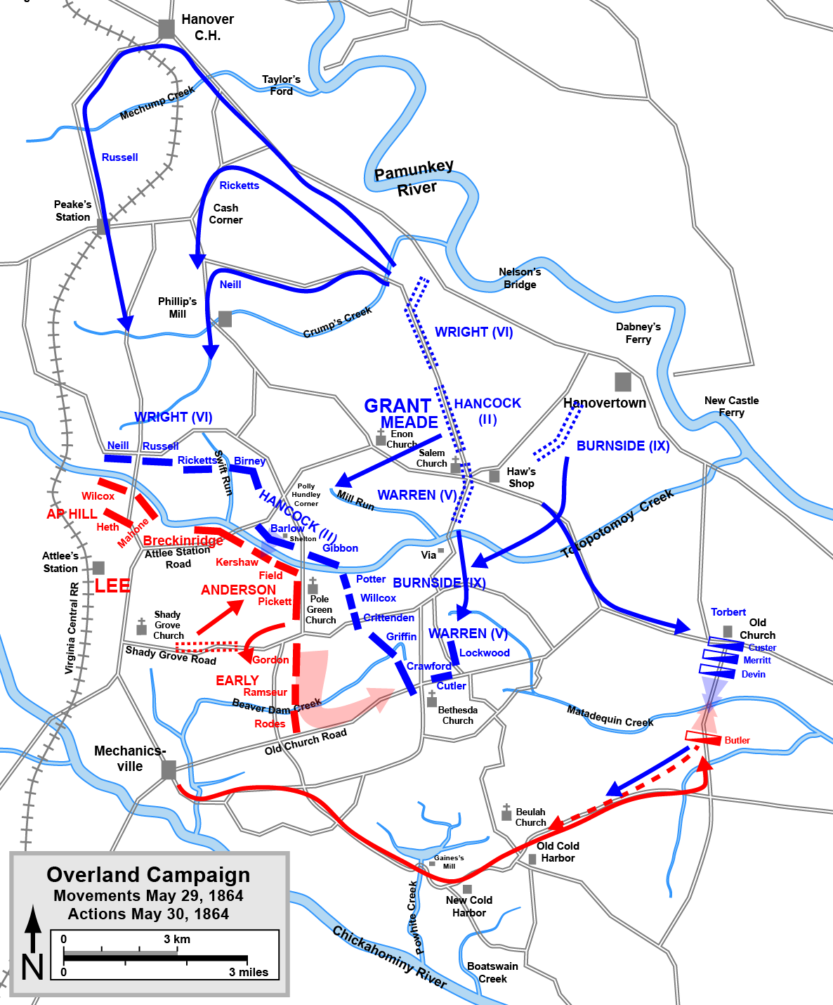
English: One of a series of maps of the Overland Campaign of the American Civil War, showing the movements that led to the battles of Totopotomoy Creek (Bethesda Church) and Old Church. Drawn in Adobe Illustrator CS5 by Hal Jespersen. Graphic source file is available at http://www.posix.com/CWmaps/
Ce fichier est disponible selon les termes de la licence Creative Commons Attribution 3.0 Non transposée. Attribution: Map by Hal Jespersen, www.posix.com/CW
|
| Source | Travail personnel |
| Auteur | Hlj |
Historique du fichier
Cliquer sur une date et heure pour voir le fichier tel qu'il était à ce moment-là.
| Date et heure | Vignette | Dimensions | Utilisateur | Commentaire | |
|---|---|---|---|---|---|
| actuel | 17 mars 2011 à 22:17 | | 1 186 × 1 430 (374 kio) | Hlj | Minor graphical changes to conform to new ACW map style for roads and rivers. Same license. |
| 21 février 2011 à 19:47 |  | 1 186 × 1 430 (278 kio) | Hlj | Minor updates to clarify the movements and actions of the Battle of Old Church (Matadequin Creek). Same license. | |
| 18 février 2011 à 22:30 |  | 1 186 × 1 430 (268 kio) | Hlj | {{Information |Description ={{en|1=One of a series of maps of the Overland Campaign of the American Civil War, showing the movements that led to the battles of Totopotomoy Creek (Bethesda Church) and |
Utilisation du fichier
Les 2 pages suivantes utilisent ce fichier :
Usage global du fichier
Les autres wikis suivants utilisent ce fichier :
- Utilisation sur en.wikipedia.org
- Utilisation sur ja.wikipedia.org
- Utilisation sur nl.wikipedia.org
- Utilisation sur ru.wikipedia.org