
Fichier:Newham London UK blank ward map.svg

Taille de cet aperçu PNG pour ce fichier SVG : 609 × 600 pixels. Autres résolutions : 244 × 240 pixels | 488 × 480 pixels | 780 × 768 pixels | 1 040 × 1 024 pixels | 2 080 × 2 048 pixels | 1 286 × 1 266 pixels.
Fichier d’origine (Fichier SVG, nominalement de 1 286 × 1 266 pixels, taille : 395 kio)
Ce fichier et sa description proviennent de Wikimedia Commons.
| Description |
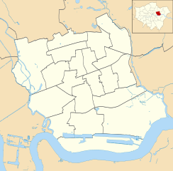
Blank map of the London Borough of Newham, showing electoral wards. Equirectangular map projection on WGS 84 datum, with N/S stretched 160% Geographic limits:
|
| Date | |
| Source |
|
| Auteur | Nilfanion |
| Autorisation (Réutilisation de ce fichier) |
Ce fichier est disponible selon les termes de la licence Creative Commons Attribution – Partage dans les Mêmes Conditions 3.0 (non transposée). Attribution: Contains Ordnance Survey data © Crown copyright and database right
|
Historique du fichier
Cliquer sur une date et heure pour voir le fichier tel qu'il était à ce moment-là.
| Date et heure | Vignette | Dimensions | Utilisateur | Commentaire | |
|---|---|---|---|---|---|
| actuel | 29 juillet 2011 à 00:13 | | 1 286 × 1 266 (395 kio) | Nilfanion | {{Information |Description=Blank map of the London Borough of Newham, showing electoral wards. Equirectangular map projection on WGS 84 datum, with N/S stretched 160% Geographic limits: *West: 0.03W *East: 0.1E *North: 51. |
Utilisation du fichier
La page suivante utilise ce fichier :
Usage global du fichier
Les autres wikis suivants utilisent ce fichier :
- Utilisation sur en.wikipedia.org
- Utilisation sur he.wikipedia.org
- Utilisation sur pl.wikipedia.org
- Boleyn Ground
- Port lotniczy Londyn-City
- Canning Town (stacja metra)
- West Ham (stacja kolejowa)
- Stratford (stacja)
- Stadion Olimpijski w Londynie
- London Velopark
- Basketball Arena w Londynie
- Aquatics Centre w Londynie
- Water Polo Arena
- ArcelorMittal Orbit
- ExCeL
- Moduł:Mapa/dane/Newham
- Moduł:Mapa/dane/GB-NWM
- Silvertown
- Utilisation sur pl.wikibooks.org