
Fichier:Minnesota Lock and Dam 1 006-062-02-1994.jpg
Taille de cet aperçu : 605 × 600 pixels. Autres résolutions : 242 × 240 pixels | 484 × 480 pixels | 929 × 921 pixels.
Fichier d’origine (929 × 921 pixels, taille du fichier : 246 kio, type MIME : image/jpeg)
Ce fichier et sa description proviennent de Wikimedia Commons.
Description
| Description |
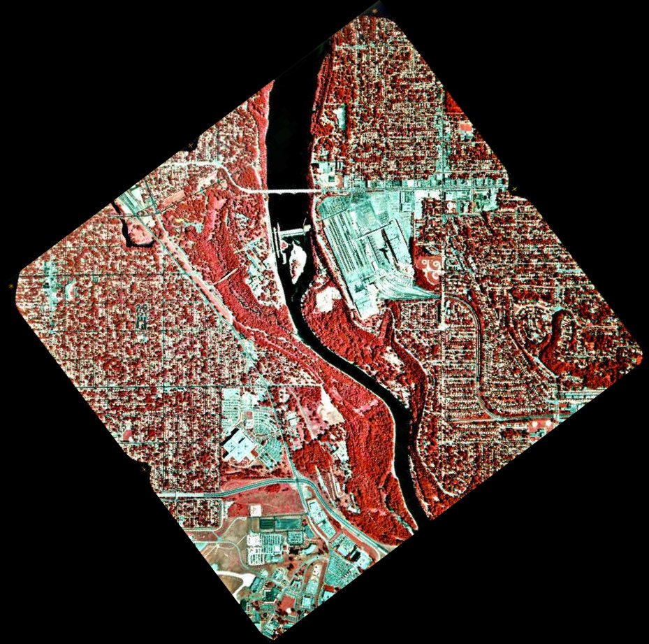
English: 1994 infrared photo of the Mississippi River between Minneapolis and Saint Paul.
Related images
|
| Source |
Transféré de en.wikipedia à Commons par Deep silence. (original:ftp://ftp.umesc.er.usgs.gov/pub/gis_data/aerial_photos/1994_upper_mississippi_72dpi/pool_02/006-062-02-1994.jpg) |
| Auteur |
.jpg)

Conditions d’utilisation
Cette image est placée dans le domaine public parce qu'elle contient des éléments issus de l'United States Geological Survey, une agence du Département de l'Intérieur des États-Unis. Pour plus d'information, consultez la politique officielle de copyright de l'USGS (en anglais)
|
Journal des téléversements d’origine
La page de description originale était ici. Tous les noms d'utilisateur qui suivent se rapportent à en.wikipedia.
- 2005-08-20 04:55 SEWilco 929×921× (252387 bytes) 1994 infrared photo of the [[Mississippi River]] between [[Minneapolis, Minnesota|Minneapolis]] and [[Saint Paul, Minnesota|Saint Paul]]. Ford Bridge is just north of Lock and Dam 1, between the Saint Paul Ford Assembly Plant on the right, and Minnehaha
Historique du fichier
Cliquer sur une date et heure pour voir le fichier tel qu'il était à ce moment-là.
| Date et heure | Vignette | Dimensions | Utilisateur | Commentaire | |
|---|---|---|---|---|---|
| actuel | 6 juillet 2010 à 15:39 | | 929 × 921 (246 kio) | Deep silence | {{Information |Description={{en|1994 infrared photo of the en:Mississippi River between Minneapolis and Saint Paul. * North is up. * Dark red is vegetation while bluish-green is roads, as |
Utilisation du fichier
La page suivante utilise ce fichier :
Usage global du fichier
Les autres wikis suivants utilisent ce fichier :
- Utilisation sur en.wikipedia.org
- Utilisation sur fa.wikipedia.org
- Utilisation sur hy.wikipedia.org
- Utilisation sur te.wikipedia.org