
Fichier:Map India and Pakistan 1-250,000 Tile NF 45-11, Contai.jpg

Taille de cet aperçu : 795 × 599 pixels. Autres résolutions : 318 × 240 pixels | 637 × 480 pixels | 1 019 × 768 pixels | 1 280 × 965 pixels | 2 560 × 1 930 pixels | 5 000 × 3 770 pixels.
Fichier d’origine (5 000 × 3 770 pixels, taille du fichier : 1,32 Mio, type MIME : image/jpeg)
Ce fichier et sa description proviennent de Wikimedia Commons.
Description
| Description |
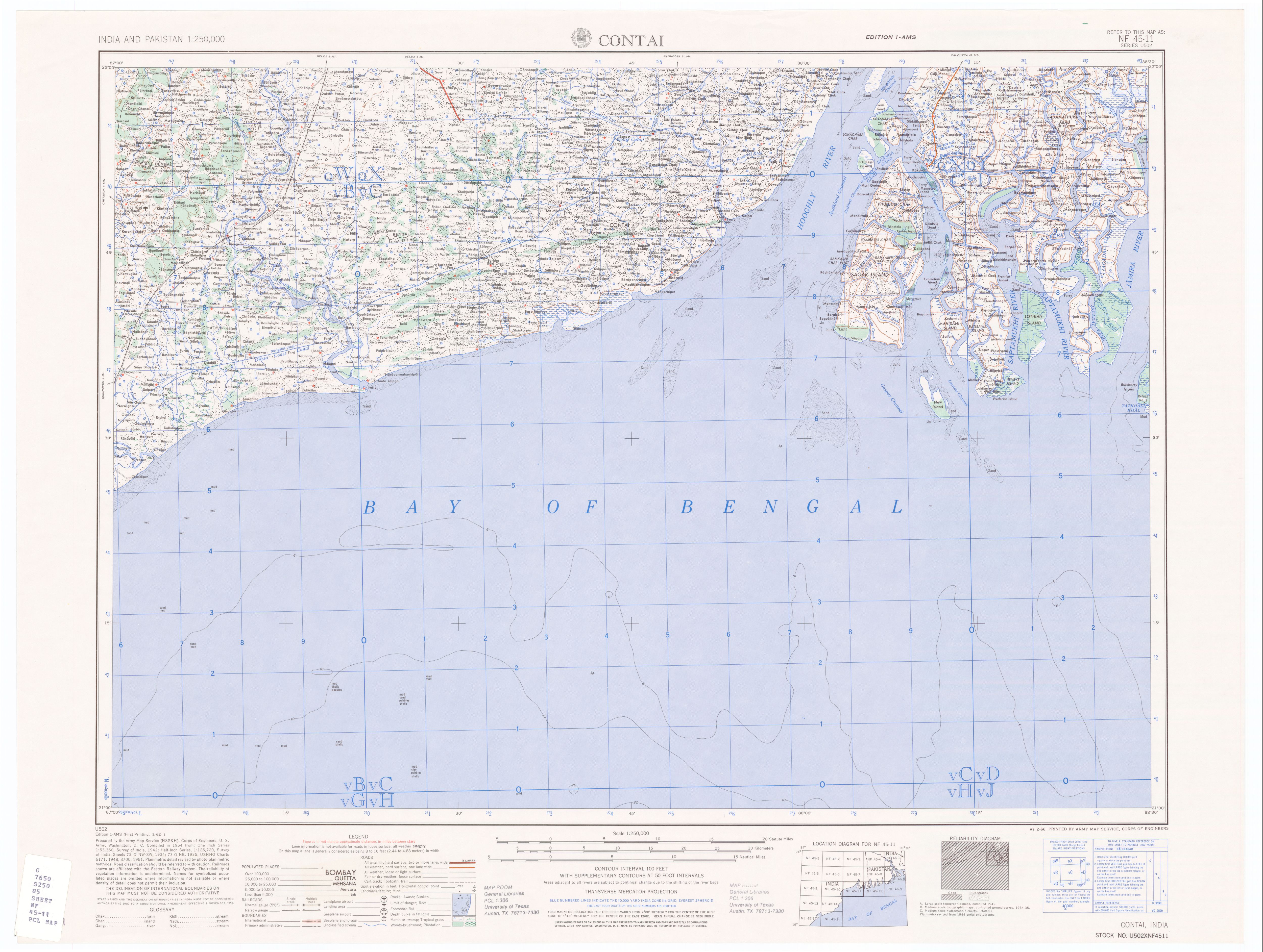
50% quality copy of Contai, India map by U.S. Army Map Service. Compiled in 1954. |
|||||||||
| Source | http://www.lib.utexas.edu/maps/ams/india/nf-45-11.jpg linked from http://www.lib.utexas.edu/maps/ams/india/ | |||||||||
| Créé par |
U.S. Army Map Service, Corps of Engineers |
|||||||||
| Autorisation (Réutilisation de ce fichier) |
PD U.S. Government work. "Courtesy of the University of Texas Libraries, The University of Texas at Austin." | |||||||||
| Données géotemporelles | ||||||||||
| Rectangle englobant |
|
|||||||||
| Géoréférencement | ||||||||||
| Autres versions |
Œuvres dérivées de ce fichier : |
|||||||||
Conditions d’utilisation
Ce média est dans le domaine public des États-Unis d’Amérique car son auteur est l’administration américaine comme précisé dans le code fédéral au Titre 17, Chapitre 1, Section 105. Pour en savoir plus : droit d’auteur.
Attention : Ceci ne concerne que le travail du Gouvernement Fédéral et pas celui des États, ou d’une autre subdivision géographique ou politique du pays.
|
 | |
| Ce fichier a été identifié comme étant exempt de restrictions connues liées au droit d’auteur, y compris tous les droits connexes et voisins. | ||
Historique du fichier
Cliquer sur une date et heure pour voir le fichier tel qu'il était à ce moment-là.
| Date et heure | Vignette | Dimensions | Utilisateur | Commentaire | |
|---|---|---|---|---|---|
| actuel | 10 janvier 2007 à 09:44 | | 5 000 × 3 770 (1,32 Mio) | SEWilco | {{Information |Description=50% quality copy of Contai, India map by U.S. Army Map Service. Compiled in 1954. |Source=http://www.lib.utexas.edu/maps/ams/india/nf-45-11.jpg linked from http://www.lib.utexas.edu/maps/ams/india/ |Date= |Author=U.S. Army Map |
Utilisation du fichier
Aucune page n’utilise ce fichier.