
Fichier:Lake Nasser (Lake Nubia) and the Toska Lakes (MODIS 2021-10-20).jpg

Fichier d’origine (2 130 × 1 566 pixels, taille du fichier : 239 kio, type MIME : image/jpeg)
Ce fichier et sa description proviennent de Wikimedia Commons.
_and_the_Toska_Lakes_(MODIS_2021-10-20).jpg?uselang=fr)
Description
| Description |
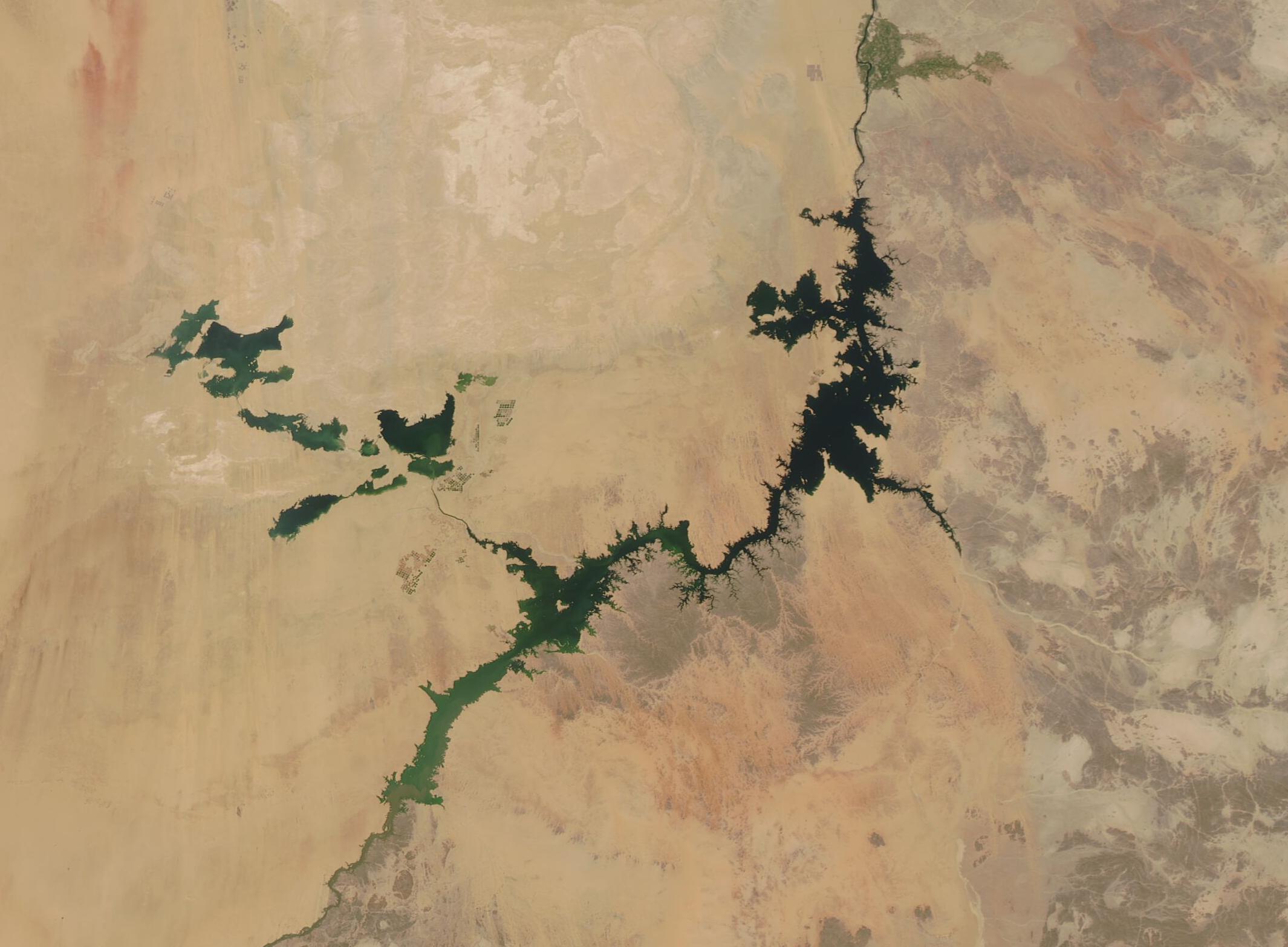
English: On October 19, 2021, the Moderate Resolution Imaging Spectroradiometer (MODIS) on board NASA’s Aqua satellite acquired a true-color image of one of the world’s largest artificial lakes. Called Lake Nasser in Egypt and Lake Nubia in Sudan, the blue waters of the sprawling reservoir stand out in stark contrast to the tans and creams of the arid deserts surrounding the lake.
Lake Nasser is named after the Egyptian President Gamal Abdul Nasser, who is largely responsible for the lake’s creation. President Nasser decided to build the Aswan High Dam across the Nile, forming a lake approximately 550 kilometers (340 miles) long. The construction of this dam was completed in 1970 after 11 years of construction. The Toshka Lakes, located to the northwest of Lake Nasser, were created in the 1980s and 1990s by the diversion of water from Lake Nasser through a manmade canal into the Sahara Desert. Flooding of the Toshka Depression created four main lakes and the opportunity to extend agriculture into the previously desert depression. Lake Nasser plays an important role in Egypt’s economy. Approximately one quarter of the nation’s population works in agriculture, which depends heavily on irrigation. With a reliable source of water from Lake Nasser, farmers have been able to plant more crops and to do so multiple times per year with the aid of fertilizers. After the reservoir was filled, the country was able to increase its arable land by 30 percent in the first few years, particularly to the west of the lake. Lake Nasser has also created a fishing industry and is a popular tourist attraction due to its crocodiles and historic monuments that were saved by moving them from the now-flooded areas before the reservoir was completed. |
||
| Date | Prise le 19 octobre 2021 | ||
| Source |
Lake Nasser (Lake Nubia) and the Toska Lakes (direct link)
|
||
| Auteur | MODIS Land Rapid Response Team, NASA GSFC |
| This media is a product of the Aqua mission Credit and attribution belongs to the mission team, if not already specified in the "author" row |
Conditions d’utilisation
| Ce fichier provient de la NASA. Sauf exception, les documents créés par la NASA ne sont pas soumis à copyright. Pour plus d'informations, voir la politique de copyright de la NASA. | ||
 |
Attention :
|
Historique du fichier
Cliquer sur une date et heure pour voir le fichier tel qu'il était à ce moment-là.
| Date et heure | Vignette | Dimensions | Utilisateur | Commentaire | |
|---|---|---|---|---|---|
| actuel | 28 janvier 2024 à 20:49 | | 2 130 × 1 566 (239 kio) | OptimusPrimeBot | #Spacemedia - Upload of http://modis.gsfc.nasa.gov/gallery/images/image10202021_250m.jpg via Commons:Spacemedia |
Utilisation du fichier
La page suivante utilise ce fichier :
_and_the_Toska_Lakes_(MODIS_2021-10-20).jpg)