
Fichier:India Bangladesh border US Army Map Service.jpg

Fichier d’origine (680 × 788 pixels, taille du fichier : 288 kio, type MIME : image/jpeg)
Ce fichier et sa description proviennent de Wikimedia Commons.
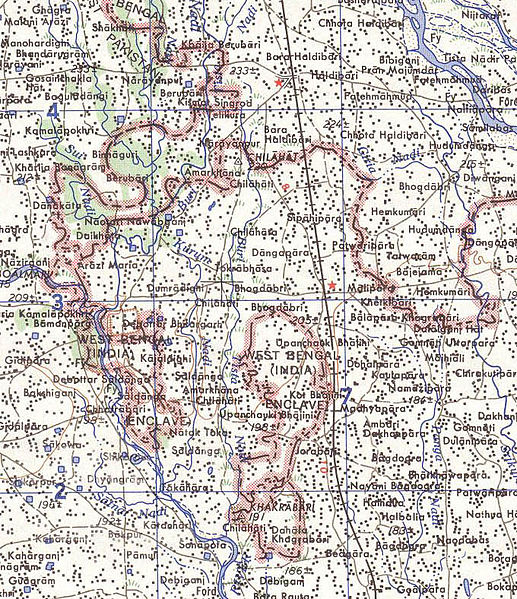
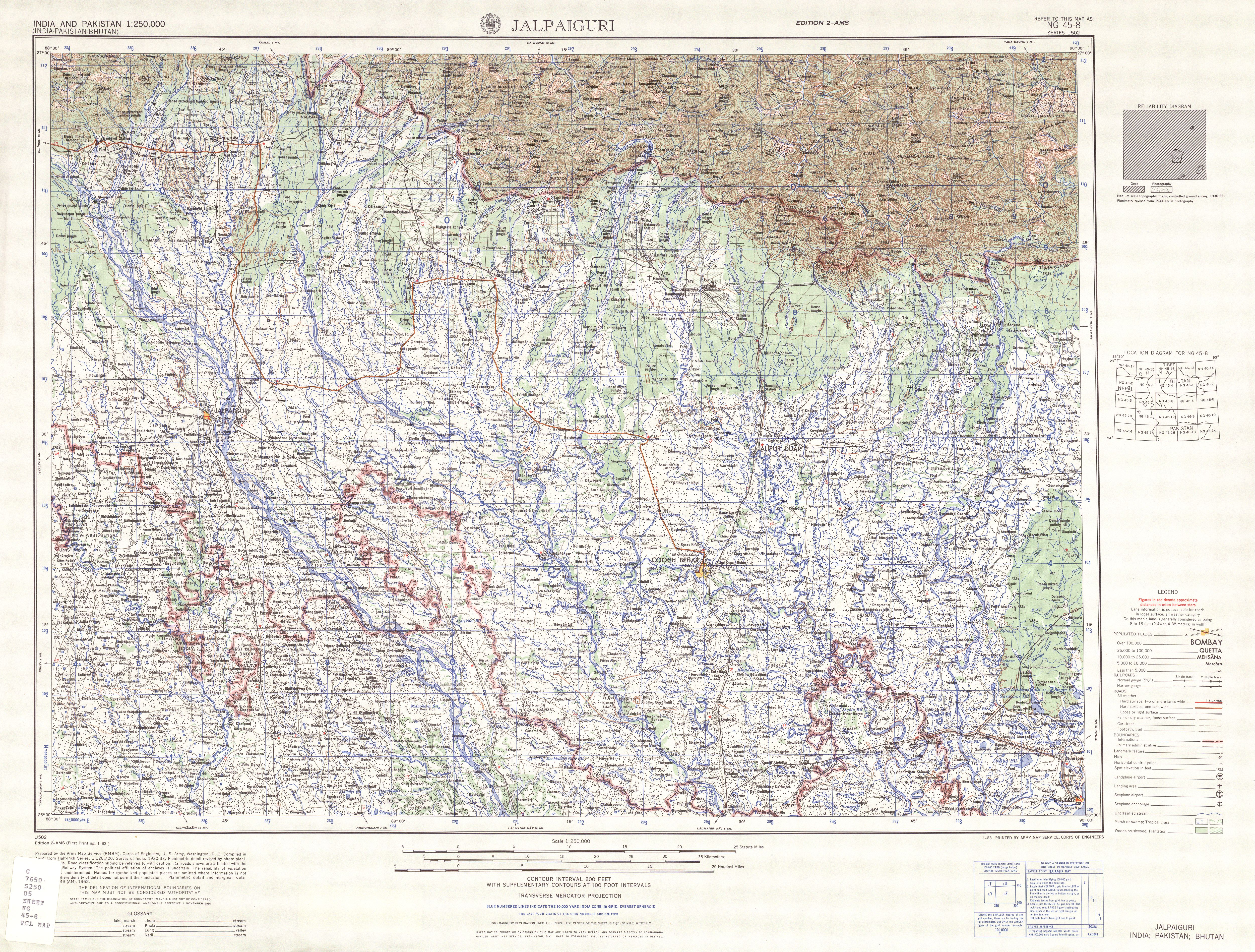
Map of part of the India-north Bangladesh border, US army map service, 1960s. Shows a couple of the larger exclaves of India, but is simplified due to the tiny size of many of them. Located in area near 26°15′43″N 88°45′6″E / 26.26194°N 88.75167°E There were at least 129 smaller enclaves and second-level enclaves on both sides of this border, see external link for a more detailed map. Note: Bangladesh is shown as 'East Pakistan'.
Ce média est dans le domaine public des États-Unis d’Amérique car son auteur est l’administration américaine comme précisé dans le code fédéral au Titre 17, Chapitre 1, Section 105. Pour en savoir plus : droit d’auteur.
Attention : Ceci ne concerne que le travail du Gouvernement Fédéral et pas celui des États, ou d’une autre subdivision géographique ou politique du pays.
|
 | |
| Ce fichier a été identifié comme étant exempt de restrictions connues liées au droit d’auteur, y compris tous les droits connexes et voisins. | ||
[üCategory:International borders of India]]
Historique du fichier
Cliquer sur une date et heure pour voir le fichier tel qu'il était à ce moment-là.
| Date et heure | Vignette | Dimensions | Utilisateur | Commentaire | |
|---|---|---|---|---|---|
| actuel | 14 mai 2007 à 12:31 | | 680 × 788 (288 kio) | Roke~commonswiki | Map of the India-Bangladesh border, US army map service, 1960s. Shows some of the enclaves on the border, but is simplified. {{PD-PCL|txu-oclc-6614190-ng45-8.jpg|/ams/india/}} Category:Maps of India Category:Maps of Bangladesh |
Utilisation du fichier
La page suivante utilise ce fichier :
Usage global du fichier
Les autres wikis suivants utilisent ce fichier :
- Utilisation sur bn.wikipedia.org
- Utilisation sur de.wikipedia.org
- Utilisation sur en.wikipedia.org
- Utilisation sur es.wikipedia.org
- Utilisation sur ja.wikipedia.org
- Utilisation sur mt.wikipedia.org
- Utilisation sur nl.wikipedia.org
- Utilisation sur pt.wikipedia.org