
Fichier:Ince Castle - geograph.org.uk - 344828.jpg
Ince_Castle_-_geograph.org.uk_-_344828.jpg (640 × 435 pixels, taille du fichier : 63 kio, type MIME : image/jpeg)
Ce fichier et sa description proviennent de Wikimedia Commons.
Description
| Description |
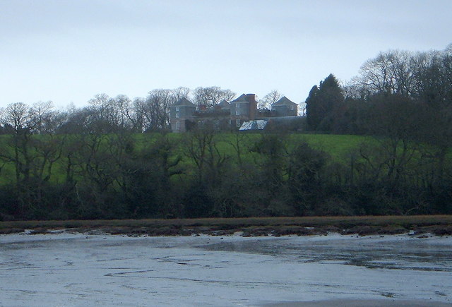
English: Ince Castle This is Ince Castle which was built in 1642 at the start of the Civil War and was captured in 1646. It consists of 4 three storey towers with walls 4 foot thick. By the 1850s it was used as a farm and was allowed to decay but it was restored in the early 20th century. It burnt down in 1986 (apparently by grandmother being a bit irresponsible with a candle) - but it has now been rebuilt.
In 1649, John Killigrew inherited Ince Castle from an uncle. He married four wives and installed them separately into each of the four towers giving them a story that the fields were plagued with mice - which kept them inside. For some time, each of the four ladies lived happily in ignorance of the other three, until a thicko servant delivered a letter to the wrong wife, and all was revealed! John Killigrew was sentenced to sixteen years, four years for each count of bigamy. John pointed out to the judge that, as his first marriage was not bigamous, he should serve only twelve years! Good lad. It is now the home of Lord and Lady Boyd who probably wouldn't like to see me making footprints in their ever so posh mud. |
| Date | |
| Source | From geograph.org.uk |
| Auteur | Bill Booth |
| Autres versions | Œuvres dérivées de ce fichier : Ince Castle - geograph.org.uk - 344828 cropped.jpg |
| Lieu de la prise de vue | | Voir cet endroit et d’autres images sur : OpenStreetMap |
|---|
_heading:225.00&language=fr)
| Position de l'objet | | Voir cet endroit et d’autres images sur : OpenStreetMap |
|---|
_heading:225.00&language=fr)
Conditions d’utilisation

|
Cette image provient de la collection du projet Geograph British Isles. Pour obtenir les coordonnées du photographe, veuillez consulter cette page de description de l'image sur le site du projet. Les droits d'auteurs sur cette image sont détenus par Bill Booth ; l'image est placée sous une licence Creative Commons avec mention de paternité et partage à l'identique (CC-By-SA) en version 2.0.
|
- Vous êtes libre :
- de partager – de copier, distribuer et transmettre cette œuvre
- d’adapter – de modifier cette œuvre
- Sous les conditions suivantes :
- paternité – Vous devez donner les informations appropriées concernant l'auteur, fournir un lien vers la licence et indiquer si des modifications ont été faites. Vous pouvez faire cela par tout moyen raisonnable, mais en aucune façon suggérant que l’auteur vous soutient ou approuve l’utilisation que vous en faites.
- partage à l’identique – Si vous modifiez, transformez, ou vous basez sur cette œuvre, vous devez distribuer votre contribution sous la même licence ou une licence compatible avec celle de l’original.
Historique du fichier
Cliquer sur une date et heure pour voir le fichier tel qu'il était à ce moment-là.
| Date et heure | Vignette | Dimensions | Utilisateur | Commentaire | |
|---|---|---|---|---|---|
| actuel | 2 janvier 2011 à 19:18 | | 640 × 435 (63 kio) | GeographBot | == {{int:filedesc}} == {{Information |description={{en|1=Ince Castle This is Ince Castle which was built in 1642 at the start of the Civil War and was captured in 1646. It consists of 4 three storey towers with walls 4 foot thick. By the 1850s it was used |
Utilisation du fichier
La page suivante utilise ce fichier :
Usage global du fichier
Les autres wikis suivants utilisent ce fichier :
- Utilisation sur ceb.wikipedia.org
- Utilisation sur dag.wikipedia.org
- Utilisation sur da.wikipedia.org
- Utilisation sur de.wikipedia.org
- Utilisation sur en.wikipedia.org
- Utilisation sur ru.wikipedia.org
- Utilisation sur sv.wikipedia.org
- Utilisation sur www.wikidata.org