
Fichier:Heves location map.svg

Taille de cet aperçu PNG pour ce fichier SVG : 800 × 559 pixels. Autres résolutions : 320 × 223 pixels | 640 × 447 pixels | 1 024 × 715 pixels | 1 280 × 894 pixels | 2 560 × 1 787 pixels | 964 × 673 pixels.
Fichier d’origine (Fichier SVG, nominalement de 964 × 673 pixels, taille : 3,72 Mio)
Ce fichier et sa description proviennent de Wikimedia Commons.
Description
| Titre |
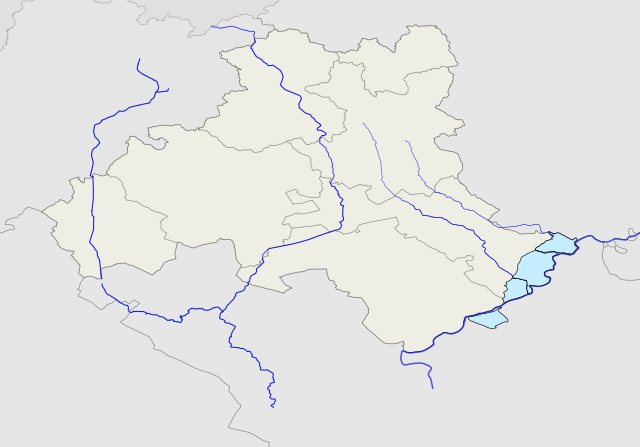
Map of Heves county |
|||||||||
| Légende de la carte | Map of Heves county | |||||||||
| Source | OpenStreetMap | |||||||||
| Créé par |
Texaner |
|||||||||
| Autorisation (Réutilisation de ce fichier) |
own work | |||||||||
| Données géotemporelles | ||||||||||
| Rectangle englobant |
|
|||||||||
| Description |
English: Location map of Heves county Hungary
Magyar: Heves megye vaktérképe |
| Date | |
| Source | Travail personnel |
| Auteur | Texaner |
Conditions d’utilisation
Moi, en tant que détenteur des droits d’auteur sur cette œuvre, je la publie sous la licence suivante :
Ce fichier est sous la licence Creative Commons Attribution – Partage dans les Mêmes Conditions 4.0 International.
- Vous êtes libre :
- de partager – de copier, distribuer et transmettre cette œuvre
- d’adapter – de modifier cette œuvre
- Sous les conditions suivantes :
- paternité – Vous devez donner les informations appropriées concernant l'auteur, fournir un lien vers la licence et indiquer si des modifications ont été faites. Vous pouvez faire cela par tout moyen raisonnable, mais en aucune façon suggérant que l’auteur vous soutient ou approuve l’utilisation que vous en faites.
- partage à l’identique – Si vous modifiez, transformez, ou vous basez sur cette œuvre, vous devez distribuer votre contribution sous la même licence ou une licence compatible avec celle de l’original.
Historique du fichier
Cliquer sur une date et heure pour voir le fichier tel qu'il était à ce moment-là.
| Date et heure | Vignette | Dimensions | Utilisateur | Commentaire | |
|---|---|---|---|---|---|
| actuel | 7 février 2017 à 09:17 | | 964 × 673 (3,72 Mio) | Texaner | cut the trimming |
| 6 février 2017 à 15:43 |  | 1 052 × 744 (1,58 Mio) | Texaner | Added the Tisza-tó | |
| 3 février 2017 à 23:05 |  | 1 052 × 744 (1,5 Mio) | Texaner | Last correction cutting | |
| 3 février 2017 à 22:52 |  | 1 052 × 744 (1,45 Mio) | Texaner | Reverted to version as of 20:22, 3 February 2017 (UTC) | |
| 3 février 2017 à 22:43 |  | 1 052 × 744 (1,5 Mio) | Texaner | Projection corrected (HD72) without Tisza-tó | |
| 3 février 2017 à 22:22 |  | 1 052 × 744 (1,45 Mio) | Texaner | Projection corrected (HD72) without Tisza-tó | |
| 29 janvier 2017 à 18:25 |  | 981 × 670 (1,15 Mio) | Texaner | User created page with UploadWizard |
Utilisation du fichier
La page suivante utilise ce fichier :
Usage global du fichier
Les autres wikis suivants utilisent ce fichier :
- Utilisation sur en.wikipedia.org
- Utilisation sur eo.wikipedia.org
- Utilisation sur hu.wikipedia.org
- Eger
- Heves vármegye
- Gyöngyös (település)
- Füzesabony
- Abasár
- Kál
- Adács
- Aldebrő
- Andornaktálya
- Apc
- Atkár
- Átány
- Balaton (település)
- Bátor (település)
- Bekölce
- Bélapátfalva
- Kápolna (település)
- Hatvan
- Lőrinci (Magyarország)
- Heves
- Szihalom
- Besenyőtelek
- Dormánd
- Egerfarmos
- Feldebrő
- Kompolt
- Mezőszemere
- Mezőtárkány
- Nagyút
- Poroszló (település)
- Sarud
- Tarnaszentmária
- Tófalu
- Újlőrincfalva
- Verpelét
- Demjén (település)
- Egerszalók
Voir davantage sur l’utilisation globale de ce fichier.