
Fichier:East of England districts 2011 map.svg

Taille de cet aperçu PNG pour ce fichier SVG : 573 × 600 pixels. Autres résolutions : 229 × 240 pixels | 459 × 480 pixels | 734 × 768 pixels | 979 × 1 024 pixels | 1 957 × 2 048 pixels | 1 210 × 1 266 pixels.
Fichier d’origine (Fichier SVG, nominalement de 1 210 × 1 266 pixels, taille : 2,14 Mio)
Ce fichier et sa description proviennent de Wikimedia Commons.
Description
| Description |
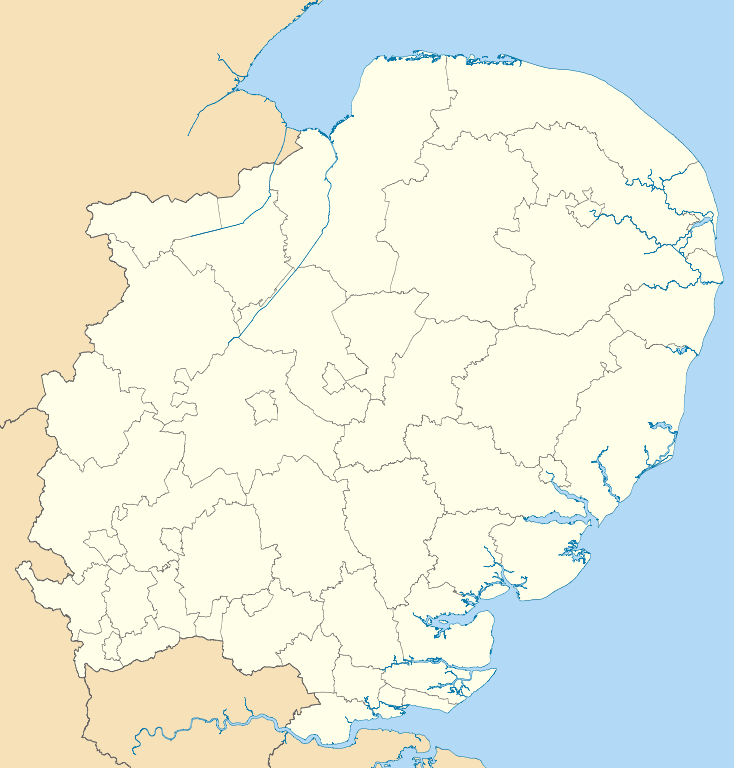
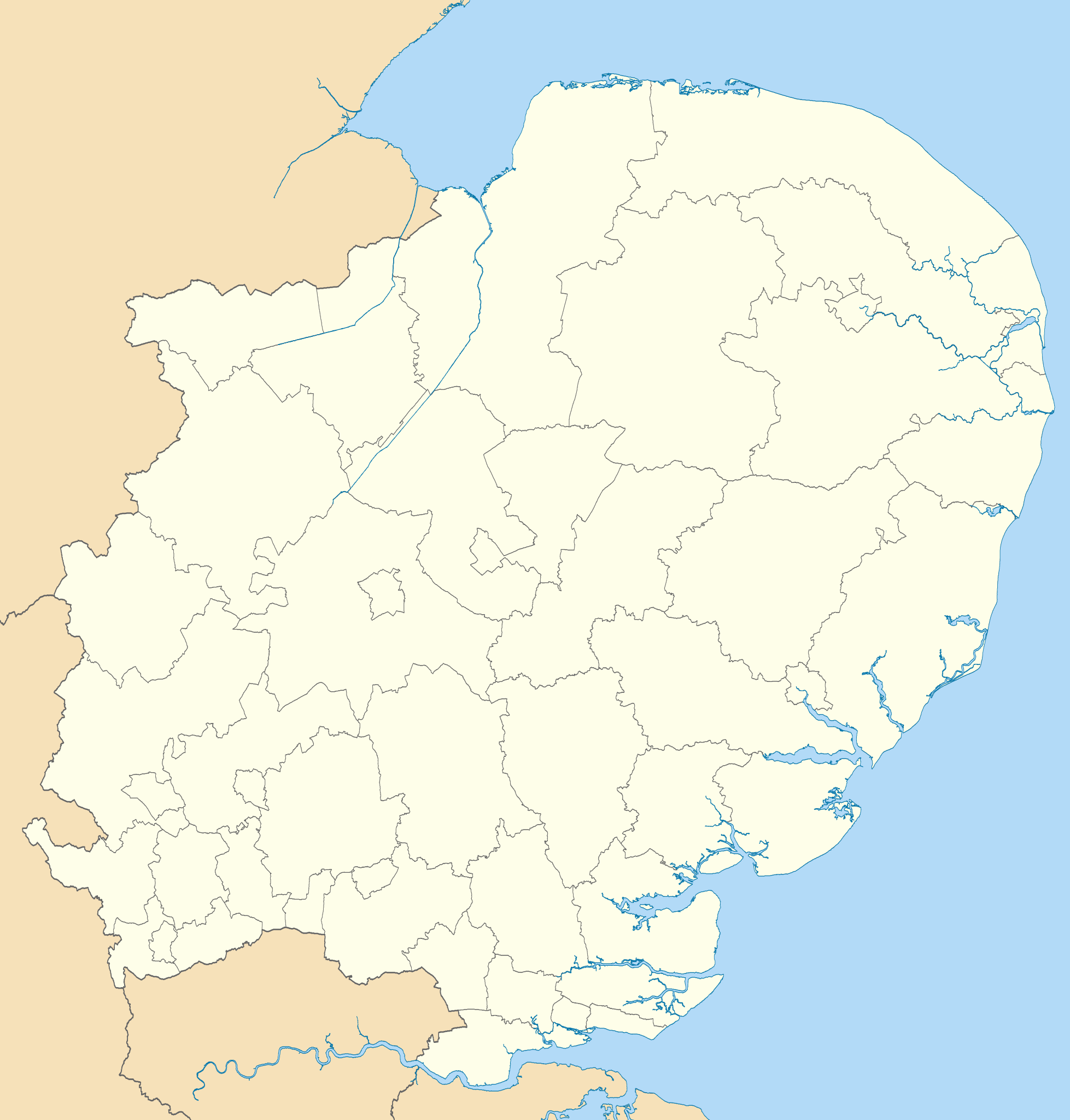
Map of the East of England region showing the administrative districts. Equirectangular map projection on WGS 84 datum, with N/S stretched 160% Geographic limits:
|
| Date | |
| Source |
|
| Auteur | Nilfanion, created using Ordnance Survey data |
| Autres versions |
Œuvres dérivées de ce fichier : |
Conditions d’utilisation
Moi, en tant que détenteur des droits d’auteur sur cette œuvre, je la publie sous les licences suivantes :
Ce fichier est disponible selon les termes de la licence Creative Commons Attribution – Partage dans les Mêmes Conditions 3.0 (non transposée).
- Vous êtes libre :
- de partager – de copier, distribuer et transmettre cette œuvre
- d’adapter – de modifier cette œuvre
- Sous les conditions suivantes :
- paternité – Vous devez donner les informations appropriées concernant l'auteur, fournir un lien vers la licence et indiquer si des modifications ont été faites. Vous pouvez faire cela par tout moyen raisonnable, mais en aucune façon suggérant que l’auteur vous soutient ou approuve l’utilisation que vous en faites.
- partage à l’identique – Si vous modifiez, transformez, ou vous basez sur cette œuvre, vous devez distribuer votre contribution sous la même licence ou une licence compatible avec celle de l’original.

|
Vous avez la permission de copier, distribuer et modifier ce document selon les termes de la GNU Free Documentation License version 1.2 ou toute version ultérieure publiée par la Free Software Foundation, sans sections inaltérables, sans texte de première page de couverture et sans texte de dernière page de couverture. Un exemplaire de la licence est inclus dans la section intitulée GNU Free Documentation License. |
Vous pouvez choisir l’une de ces licences.
Historique du fichier
Cliquer sur une date et heure pour voir le fichier tel qu'il était à ce moment-là.
| Date et heure | Vignette | Dimensions | Utilisateur | Commentaire | |
|---|---|---|---|---|---|
| actuel | 1 mai 2011 à 20:51 | | 1 210 × 1 266 (2,14 Mio) | Nilfanion | {{Information |Description=Map of the East of England region showing the administrative districts. Equirectangular map projection on WGS 84 datum, with N/S stretched 160% Geographic limits: *West: 0.8W *East: 1.8E *North: 53.1N *So |
Utilisation du fichier
Les 3 pages suivantes utilisent ce fichier :
Usage global du fichier
Les autres wikis suivants utilisent ce fichier :
- Utilisation sur ar.wikipedia.org
- Utilisation sur en.wikipedia.org
- Cambridge
- East of England
- Luton
- Ipswich
- Thurrock
- Norwich
- Huntingdonshire
- Southend-on-Sea
- Welwyn Hatfield
- Stevenage
- Harlow
- Watford
- King's Lynn and West Norfolk
- St Albans City and District
- City of Peterborough
- South Cambridgeshire
- East Cambridgeshire
- Fenland District
- Castle Point
- Uttlesford
- Tendring District
- Hertsmere
- Borough of Broxbourne
- East Hertfordshire
- North Hertfordshire
- Dacorum
- South Norfolk
- Broadland
- Breckland District
- North Norfolk
- Mid Suffolk
- Babergh District
- Template:East of England
- Borough of Bedford
- Braintree District
- City of Colchester
- Epping Forest District
- Borough of Basildon
- Maldon District
- Borough of Great Yarmouth
- Rochford District
- City of Chelmsford
- Borough of Brentwood
- Eastern Counties Football League
- Three Rivers District
- User:Mwphoto/Watford
- User:Phildav76/Regional templates
- Old Harlow
Voir davantage sur l’utilisation globale de ce fichier.