
Fichier:Charlois 1867.png

Fichier d’origine (1 600 × 1 343 pixels, taille du fichier : 202 kio, type MIME : image/png)
Ce fichier et sa description proviennent de Wikimedia Commons.
Description
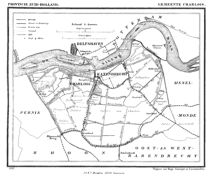
| Description | Historic map of Charlois (now part of municipality Rotterdam), South Holland, the Netherlands |
| Date | entre 1865 et 1870 |
| Source | Gemeente Atlas van Nederland (Municipal Atlas of the Netherlands) |
| Auteur | J. Kuyper |
Conditions d’utilisation
|
Cette œuvre est également dans le domaine public dans tous les pays pour lesquels le droit d’auteur a une durée de vie de 70 ans ou moins après la mort de l’auteur.
| |
| Ce fichier a été identifié comme étant exempt de restrictions connues liées au droit d’auteur, y compris tous les droits connexes et voisins. | |
Historique du fichier
Cliquer sur une date et heure pour voir le fichier tel qu'il était à ce moment-là.
| Date et heure | Vignette | Dimensions | Utilisateur | Commentaire | |
|---|---|---|---|---|---|
| actuel | 20 juillet 2007 à 19:33 | | 1 600 × 1 343 (202 kio) | P199 | {{Information |Description=Historic map of Charlois (now part of municipality Rotterdam), South Holland, the Netherlands |Source=Gemeente Atlas van Nederland (Municipal Atlas of the Netherlands) |Date=1865-1870 |Author=J. Kuyper |Permission= |other_versio |
Utilisation du fichier
La page suivante utilise ce fichier :
Usage global du fichier
Les autres wikis suivants utilisent ce fichier :