
Fichier:1771 Rizzi-Zannoni Map of Germany and Poland - Geographicus - GermanyNW-zannoni-1771.jpg
Taille de cet aperçu : 800 × 560 pixels. Autres résolutions : 320 × 224 pixels | 640 × 448 pixels | 1 024 × 717 pixels | 1 280 × 896 pixels | 2 560 × 1 792 pixels | 3 500 × 2 450 pixels.
Fichier d’origine (3 500 × 2 450 pixels, taille du fichier : 3,04 Mio, type MIME : image/jpeg)
Ce fichier et sa description proviennent de Wikimedia Commons.
Description
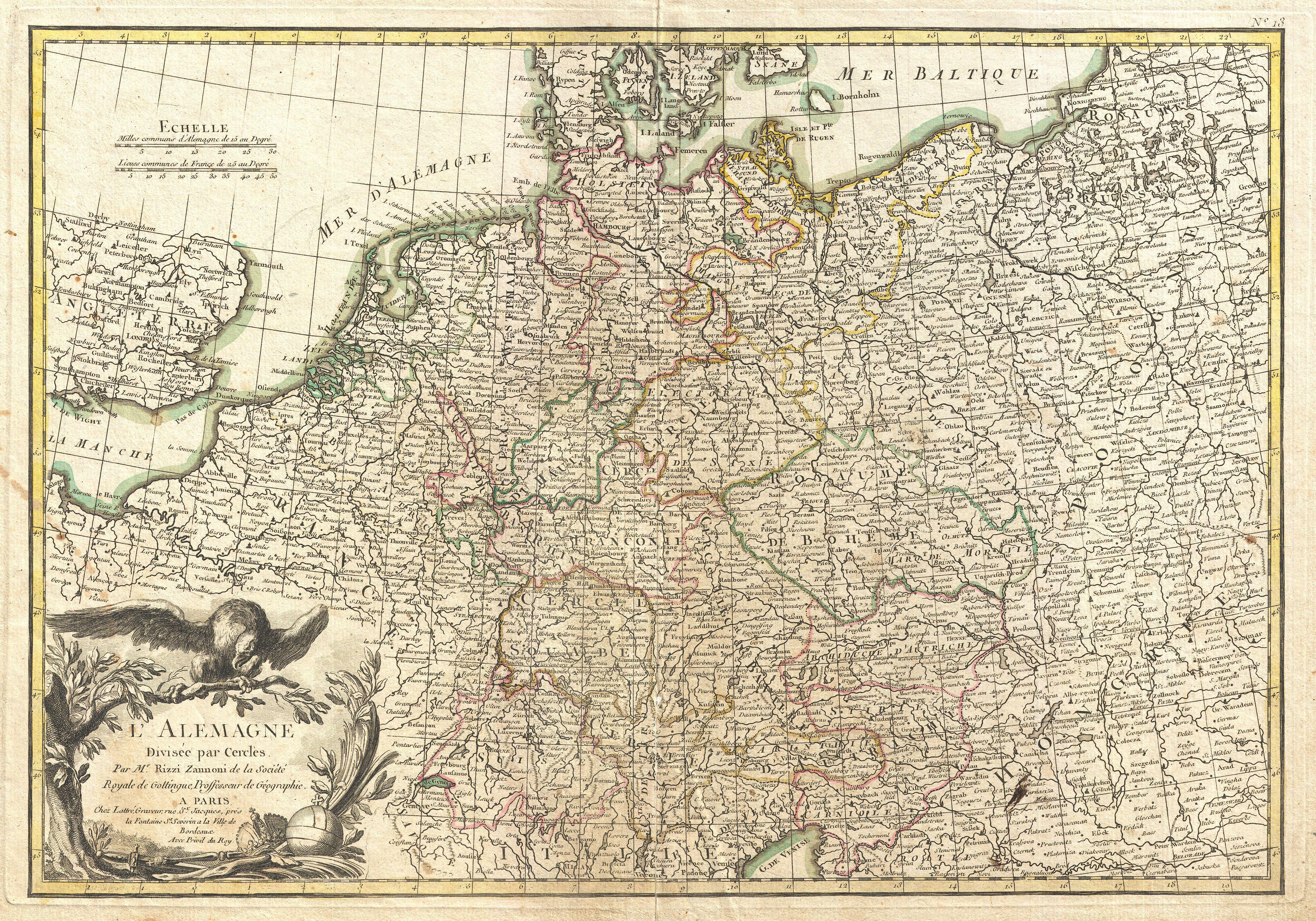
| L'Alemagne Divisee par Cercles. | ||||||
|---|---|---|---|---|---|---|
| Artiste | ||||||
| Titre |
L'Alemagne Divisee par Cercles. |
|||||
| Description |
English: A beautiful example of Rizzi-Zannoni's decorative map of Germany. Covers from Jutland to the Gulf of Venice and from England to Poland.. Offers excellent detail throughout showing mountains, rivers, forests, national boundaries, regional boundaries, forts, and cities. A large decorative title cartouche depicting the Eagle of Deutschland appears in the lower left quadrant. Drawn by Rizzi-Zannon in 1762 for issue as plate no. 13 in Jean Lattre's 1776 edition of the Atlas Moderne . |
|||||
| Date | 1771 (undated) | |||||
| Dimensions | hauteur : 12,5 pouces (31,7 cm) ; largeur : 17,5 pouces (44,4 cm) | |||||
| Numéro d’inventaire |
liens Geographicus : GermanyNW-zannoni-1771 |
|||||
| Source / photographe |
Lattre, Jean, Atlas Moderne ou Collection de Cartes sur Toutes les Parties du Globe Terrestre, c. 1775.
|
|||||
| Autorisation (Réutilisation de ce fichier) |
|
|||||
Historique du fichier
Cliquer sur une date et heure pour voir le fichier tel qu'il était à ce moment-là.
| Date et heure | Vignette | Dimensions | Utilisateur | Commentaire | |
|---|---|---|---|---|---|
| actuel | 23 mars 2011 à 19:57 | | 3 500 × 2 450 (3,04 Mio) | BotMultichillT | {{subst:User:Multichill/Geographicus |link=http://www.geographicus.com/P/AntiqueMap/GermanyNW-zannoni-1771 |product_name=1771 Rizzi-Zannoni Map of Germany and Poland |map_title=L'Alemagne Divisee par Cercles. |description=A beautiful example of Rizzi-Zann |
Utilisation du fichier
La page suivante utilise ce fichier :
Usage global du fichier
Les autres wikis suivants utilisent ce fichier :
- Utilisation sur id.wikipedia.org
- Utilisation sur lt.wikibooks.org