
Fichier:1584 Ortelius Map of Crete (Candia) and 10 Greek Islands - Geographicus - CandiaInsula-ortelius-1584.jpg
Taille de cet aperçu : 800 × 579 pixels. Autres résolutions : 320 × 232 pixels | 640 × 463 pixels | 1 024 × 741 pixels | 1 280 × 926 pixels | 2 560 × 1 853 pixels | 4 000 × 2 895 pixels.
Fichier d’origine (4 000 × 2 895 pixels, taille du fichier : 2,94 Mio, type MIME : image/jpeg)
Ce fichier et sa description proviennent de Wikimedia Commons.
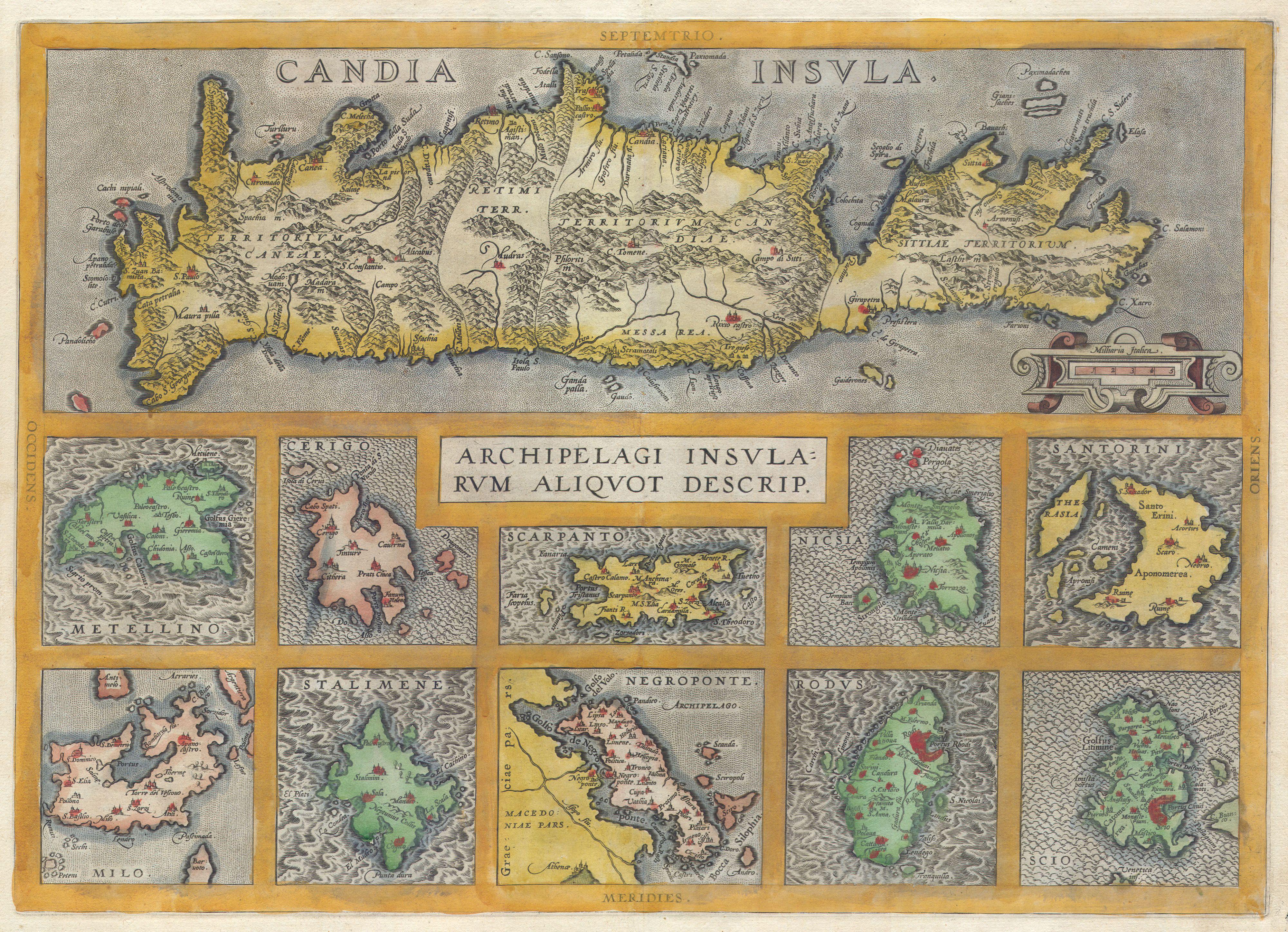
| Abraham Ortelius : Candia Insula - Archipelagi Insularum Aliquot Descrip.
( |
||||||||||||||||||||||||
|---|---|---|---|---|---|---|---|---|---|---|---|---|---|---|---|---|---|---|---|---|---|---|---|---|
| Artiste |
|
|||||||||||||||||||||||
| Titre |
Candia Insula - Archipelagi Insularum Aliquot Descrip. |
|||||||||||||||||||||||
| Description |
English: A rare and beautiful 1584 Abraham Ortelius map of Crete and ten other Greek islands: Metellino (Mitiline, Lesbos), Cerigo, Scarpanto (Karpathos), Nicsia (Naxos), Santorini, Milo, Stalimene (Limnos), Negroponte (Euboea), Rodus (Rhodes, home of the Colossus of Rhodes), and Scio (Chios). Beautiful, rich, hand color. |
|||||||||||||||||||||||
| Date | 1584 | |||||||||||||||||||||||
| Dimensions | hauteur : 14,5 pouces (36,8 cm) ; largeur : 20 pouces (50,8 cm) | |||||||||||||||||||||||
| Numéro d’inventaire |
liens Geographicus : CandiaInsula-ortelius-1584 |
|||||||||||||||||||||||
| Source / photographe |
|
|||||||||||||||||||||||
| Autorisation (Réutilisation de ce fichier) |
|
|||||||||||||||||||||||
| Autres versions | ||||||||||||||||||||||||

_and_10_Greek_Islands_-_Geographicus_-_CandiaInsula-ortelius-1584.jpg?uselang=fr)
_and_10_Greek_Islands_-_Geographicus_-_CandiaInsula-ortelius-1584_(cropped).jpg)
Historique du fichier
Cliquer sur une date et heure pour voir le fichier tel qu'il était à ce moment-là.
| Date et heure | Vignette | Dimensions | Utilisateur | Commentaire | |
|---|---|---|---|---|---|
| actuel | 24 mars 2011 à 10:46 | | 4 000 × 2 895 (2,94 Mio) | BotMultichillT | {{subst:User:Multichill/Geographicus |link=http://www.geographicus.com/P/AntiqueMap/CandiaInsula-ortelius-1584 |product_name=1584 Ortelius Map of Crete (Candia) and 10 Greek Islands |map_title=Candia Insula - Archipelagi Insularum Aliquot Descrip. |descri |
Utilisation du fichier
La page suivante utilise ce fichier :
Usage global du fichier
Les autres wikis suivants utilisent ce fichier :
- Utilisation sur en.wikipedia.org
- Utilisation sur nl.wikipedia.org
_and_10_Greek_Islands_-_Geographicus_-_CandiaInsula-ortelius-1584.jpg)