Aller au contenu

Fichier:Natal province - descriptive guide and official hand-book (1911) (14573649680).jpg

Le contenu de la page n’est pas pris en charge dans d’autres langues.
Une page de Wikipédia, l'encyclopédie libre.

Fichier d’origine(2 678 × 1 372 pixels, taille du fichier : 421 kio, type MIME : image/jpeg)

Ce fichier et sa description proviennent de Wikimedia Commons.

Description

Description
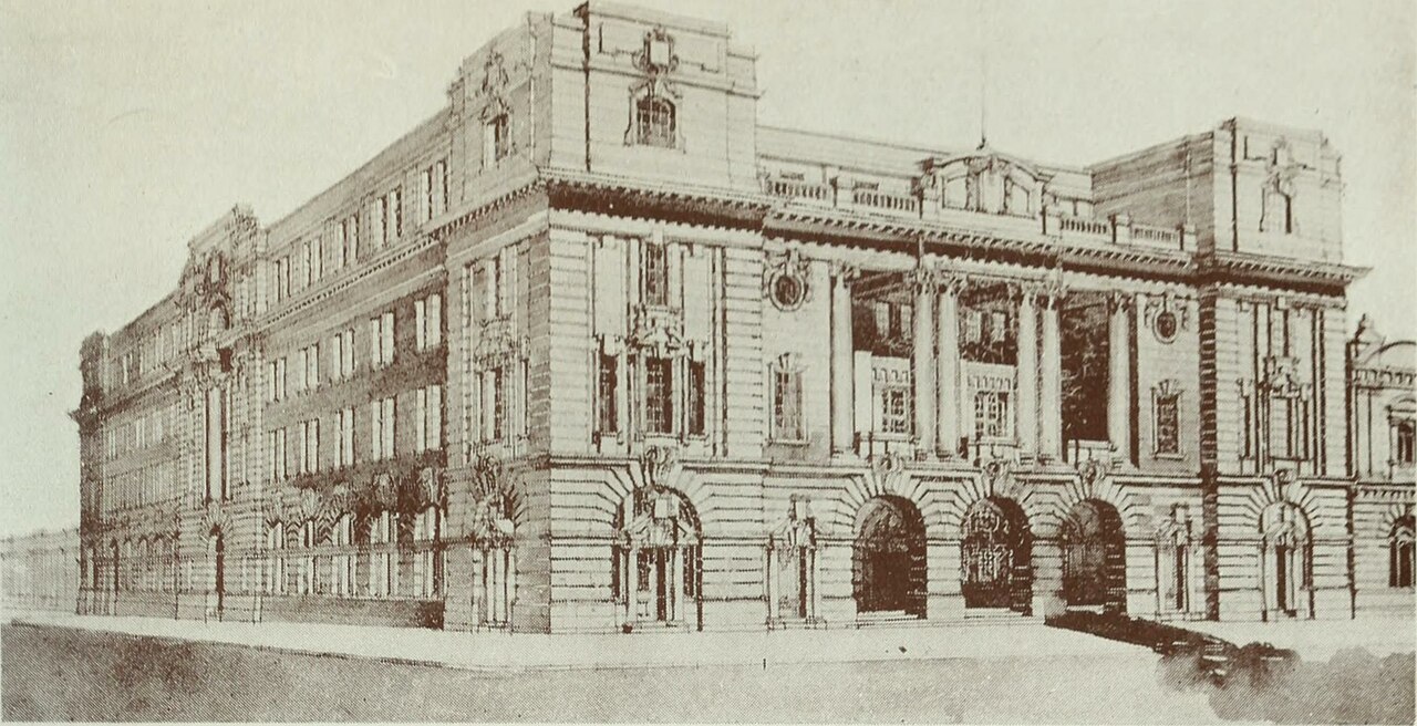
English: Post Office, Pretoria

Identifier: natalprovincedes00tatl (find matches)
Title: Natal province : descriptive guide and official hand-book
Year: 1911 (1910s)
Authors: Tatlow, A.H South African Railways. Publicity Dept
Subjects: Railroads
Publisher: Durban, Natal : South African Railways Printing Works
Contributing Library: Robarts - University of Toronto
Digitizing Sponsor: University of Toronto

View Book Page: Book Viewer
About This Book: Catalog Entry
View All Images: All Images From Book
Click here to view book online to see this illustration in context in a browseable online version of this book.

Text Appearing Before Image:
Proposed Museum, Pretoria Concerning the Transvaal The Transvaal Province lies between the 22nd and 28th parallel of South latitude, and the 25th and 32nd degrees of East longitude. The area of the country is 113,642 square miles. The population in 1899 was 167,150 men, 122,350 women — a total of 289,500 whites, and 589,126 natives; and in 1904 299,327 whites, and 969,389 natives including men and women. The southern portion of the Province is traversed from west to east by a high plateau, which forms the watershed between the rivers running south and those running north, of which the chief are the Vaal and the Limpopo. Besides this plateau, called the Hooge Veld, there are three mountain ranges which cross the country from west to east, of which the most northerly is called the Zoutpansberg, in the district of the same name. Detached ranges, which are continuations of the Drakensberg, extend from the Natal boundary across the Olifants River as far as the Limpopo, the northern limit of the
Text Appearing After Image:
Post Office, Pretoria Transvaal, and these rise in places to some 7,000 feet. Owing to the elevation of the country, which is over 4,000 feet above the sea, the climate is healthy, the winter being especially bracing. This season extends from April to August, and is generally dry. The monthly mean temperature during the summer ranges from 65 to 73 degrees, and during the winter from 59 to 65 degrees. The country is well-watered, as in the Orange Free State it is supplied with numerous pans and lakelets, the largest of which is Lake Chrissie, 36 miles in circumference. Horses, cattle, and sheep thrive well, and in the middle and northern parts of the Province vegetation is luxuriant, and many extensive forests occur.

Note About Images

Please note that these images are extracted from scanned page images that may have been digitally enhanced for readability - coloration and appearance of these illustrations may not perfectly resemble the original work.
Date
Source

https://www.flickr.com/photos/internetarchivebookimages/14573649680/

Auteur Internet Archive Book Images
Autorisation
(Réutilisation de ce fichier)
At the time of upload, the image license was automatically confirmed using the Flickr API. For more information see Flickr API detail.
Flickr tags
InfoField
  • bookid:natalprovincedes00tatl
  • bookyear:1911
  • bookdecade:1910
  • bookcentury:1900
  • bookauthor:Tatlow__A_H
  • bookauthor:South_African_Railways__Publicity_Dept
  • booksubject:Railroads
  • bookpublisher:Durban__Natal___South_African_Railways_Printing_Works
  • bookcontributor:Robarts___University_of_Toronto
  • booksponsor:University_of_Toronto
  • bookleafnumber:248
  • bookcollection:robarts
  • bookcollection:toronto
Flickr posted date
InfoField
27 juillet 2014


Conditions d’utilisation

Cette image est issue de la collection The Commons du site Flickr. Les organismes y partageant leur collection déclarent qu'à leur connaissance, aucune restriction de droit d'auteur ne fait obstacle à leur diffusion, pour l'une des raisons suivantes :
  1. l'œuvre est dans le domaine public car les droits d'auteur ont expiré ;
  2. l'œuvre a été rattachée au domaine public pour d'autres raisons, tel que le non respect des conditions nécessaires pour renouveler des droits d'auteur ;
  3. l'organisme est détenteur des droits d'auteur mais ne ne souhaite pas exercer son contrôle ou ;
  4. l'organisme possède des droits suffisant pour permettre à des tiers d'utiliser ces travaux sans aucune restriction.

La page https://flickr.com/commons/usage/ donne à ce sujet plus d'informations.


Merci d'ajouter des bandeaux de licence supplémentaires à cette image si des informations plus spécifiques sont disponibles à propos du statut de cette image. Consultez Commons:À propos des licences pour plus d'informations.
Cette image a été originellement postée sur Flickr par Internet Archive Book Images à l'adresse https://flickr.com/photos/126377022@N07/14573649680. Elle a été passée en revue le 8 octobre 2015 par le robot FlickreviewR, qui a confirmé qu'elle se trouvait sous licence No known copyright restrictions.

8 octobre 2015

Légendes

Ajoutez en une ligne la description de ce que représente ce fichier

Éléments décrits dans ce fichier

dépeint

image/jpeg

Historique du fichier

Cliquer sur une date et heure pour voir le fichier tel qu'il était à ce moment-là.

Date et heureVignetteDimensionsUtilisateurCommentaire
actuel8 octobre 2015 à 20:13Vignette pour la version du 8 octobre 2015 à 20:132 678 × 1 372 (421 kio)== {{int:filedesc}} == {{information |description={{en|1=<br> '''Identifier''': natalprovincedes00tatl ([https://commons.wikimedia.org/w/index.php?title=Special%3ASearch&profile=default&fulltext=Search&search=insource%3A%2Fnatalprovincedes00tatl%2F fin...

La page suivante utilise ce fichier :

Usage global du fichier

Les autres wikis suivants utilisent ce fichier :