
Fichier:Karte - Englisch-Spanischer Krieg in der Karibik 1726-1728.png
Taille de cet aperçu : 768 × 600 pixels. Autres résolutions : 307 × 240 pixels | 615 × 480 pixels | 983 × 768 pixels | 1 188 × 928 pixels.
Fichier d’origine (1 188 × 928 pixels, taille du fichier : 172 kio, type MIME : image/png)
Ce fichier et sa description proviennent de Wikimedia Commons.
Description
| Description |
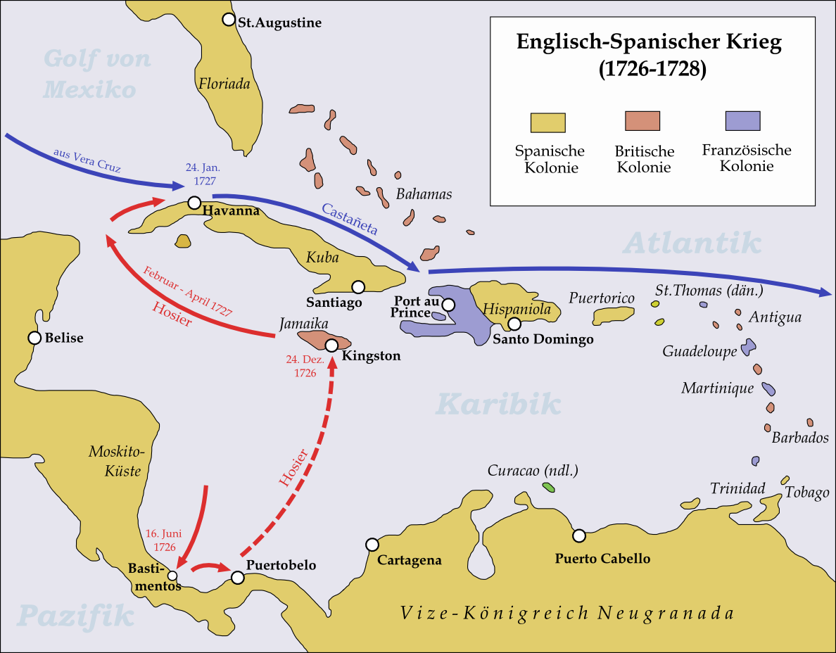
English: Map showing the operations in the Caribbean during the Anglo-Spanish War 1726-28. |
| Date | |
| Source | Travail personnel |
| Auteur | Memnon335bc |
Conditions d’utilisation
Moi, en tant que détenteur des droits d’auteur sur cette œuvre, je la publie sous la licence suivante :
Ce fichier est disponible selon les termes de la licence Creative Commons Attribution 3.0 Non transposée.
- Vous êtes libre :
- de partager – de copier, distribuer et transmettre cette œuvre
- d’adapter – de modifier cette œuvre
- Sous les conditions suivantes :
- paternité – Vous devez donner les informations appropriées concernant l'auteur, fournir un lien vers la licence et indiquer si des modifications ont été faites. Vous pouvez faire cela par tout moyen raisonnable, mais en aucune façon suggérant que l’auteur vous soutient ou approuve l’utilisation que vous en faites.
Historique du fichier
Cliquer sur une date et heure pour voir le fichier tel qu'il était à ce moment-là.
| Date et heure | Vignette | Dimensions | Utilisateur | Commentaire | |
|---|---|---|---|---|---|
| actuel | 31 mai 2015 à 23:46 | | 1 188 × 928 (172 kio) | Cmdrjameson | Compressed with pngout. Reduced by 94kB (35% decrease). |
| 22 mars 2011 à 23:24 |  | 1 188 × 928 (267 kio) | Memnon335bc | {{Information |Description ={{en|1=Map showing the operations in the Caribbean during the Anglo-Spanish War 1726-28.}} |Source ={{own}} |Author =Memnon335bc |Date =2011-03 |Permission = |other_versions |
Utilisation du fichier
La page suivante utilise ce fichier :
Usage global du fichier
Les autres wikis suivants utilisent ce fichier :
- Utilisation sur de.wikipedia.org
- Utilisation sur ja.wikipedia.org