
Fichier:1777BurgoyneTiconderoga.jpg
Taille de cet aperçu : 318 × 599 pixels. Autres résolutions : 127 × 240 pixels | 255 × 480 pixels | 408 × 768 pixels | 544 × 1 024 pixels | 1 382 × 2 602 pixels.
Fichier d’origine (1 382 × 2 602 pixels, taille du fichier : 1,22 Mio, type MIME : image/jpeg)
Ce fichier et sa description proviennent de Wikimedia Commons.
| Description |
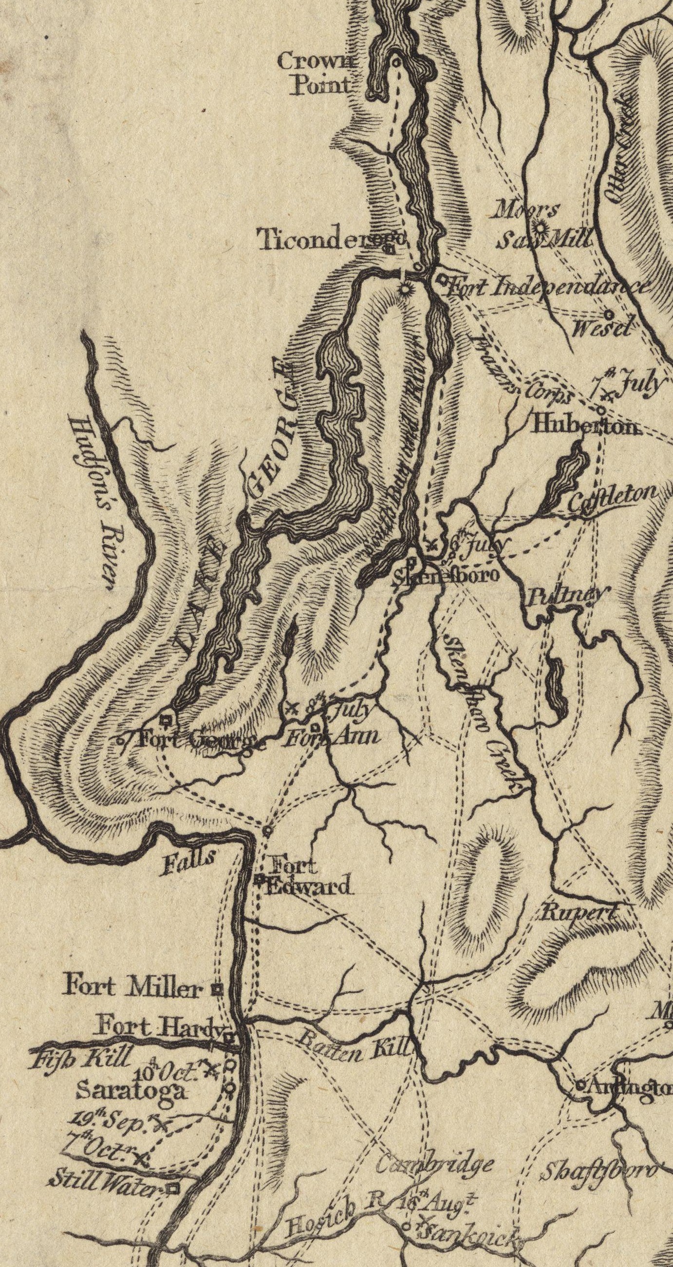
English: This is a detail from the source map, which shows the geographic area of John Burgoyne's 1777 Saratoga campaign. This detail shows the area around Fort Ticonderoga, including the roads and approaches used by the British and American forces before and after the Battle of Ticonderoga. |
||||||||||||||||||||||
| Date | |||||||||||||||||||||||
| Source | Boston Public Library Digital Map collection (call number: G3801.S3 1777 .N49) | ||||||||||||||||||||||
| Auteur |
|
||||||||||||||||||||||
| Autorisation (Réutilisation de ce fichier) |
|
||||||||||||||||||||||
Historique du fichier
Cliquer sur une date et heure pour voir le fichier tel qu'il était à ce moment-là.
| Date et heure | Vignette | Dimensions | Utilisateur | Commentaire | |
|---|---|---|---|---|---|
| actuel | 21 juin 2009 à 19:08 | | 1 382 × 2 602 (1,22 Mio) | Magicpiano | Cleaner version of map from [http://maps.bpl.org/details_11085/ Boston Public Library Map collection] |
| 27 mars 2009 à 16:14 |  | 1 036 × 1 592 (601 kio) | Magicpiano | {{Information |Description={{en|1=This is a detail from the first map in the original source, which contains maps showing the areas and military movements of w:John Burgoyne's 1777 w:Saratoga campaign. This detail shows the area around [[w:Fort |
Utilisation du fichier
Les 3 pages suivantes utilisent ce fichier :
Usage global du fichier
Les autres wikis suivants utilisent ce fichier :
- Utilisation sur de.wikipedia.org
- Utilisation sur en.wikipedia.org
- Utilisation sur it.wikipedia.org
- Utilisation sur ja.wikipedia.org
- Utilisation sur nl.wikipedia.org
- Utilisation sur pl.wikipedia.org
- Utilisation sur www.wikidata.org