
Fichier:Mazandaran.svg

Taille de cet aperçu PNG pour ce fichier SVG : 800 × 325 pixels. Autres résolutions : 320 × 130 pixels | 640 × 260 pixels | 1 024 × 416 pixels | 1 280 × 520 pixels | 2 560 × 1 040 pixels | 960 × 390 pixels.
Fichier d’origine (Fichier SVG, nominalement de 960 × 390 pixels, taille : 360 kio)
Ce fichier et sa description proviennent de Wikimedia Commons.
Description
| Description |
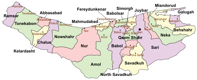
English: Mazandaran |
| Date | |
| Source | Travail personnel |
| Auteur | Ali Zifan |
Conditions d’utilisation
Moi, en tant que détenteur des droits d’auteur sur cette œuvre, je la publie sous la licence suivante :
Ce fichier est sous la licence Creative Commons Attribution – Partage dans les Mêmes Conditions 4.0 International.
- Vous êtes libre :
- de partager – de copier, distribuer et transmettre cette œuvre
- d’adapter – de modifier cette œuvre
- Sous les conditions suivantes :
- paternité – Vous devez donner les informations appropriées concernant l'auteur, fournir un lien vers la licence et indiquer si des modifications ont été faites. Vous pouvez faire cela par tout moyen raisonnable, mais en aucune façon suggérant que l’auteur vous soutient ou approuve l’utilisation que vous en faites.
- partage à l’identique – Si vous modifiez, transformez, ou vous basez sur cette œuvre, vous devez distribuer votre contribution sous la même licence ou une licence compatible avec celle de l’original.
Historique du fichier
Cliquer sur une date et heure pour voir le fichier tel qu'il était à ce moment-là.
| Date et heure | Vignette | Dimensions | Utilisateur | Commentaire | |
|---|---|---|---|---|---|
| actuel | 26 mars 2024 à 02:11 | 960 × 390 (360 kio) | Oganesson007 | + | |
| 28 décembre 2022 à 06:21 |  | 654 × 278 (178 kio) | Oganesson007 | borders | |
| 18 mai 2021 à 18:26 |  | 654 × 278 (130 kio) | Oganesson007 | ۹۸ آپدیت نقشه بر اساس درگاه آمار ملی ایران سال | |
| 18 mai 2017 à 06:02 |  | 654 × 278 (107 kio) | Oganesson007 | User created page with UploadWizard |
Utilisation du fichier
Les 2 pages suivantes utilisent ce fichier :
Usage global du fichier
Les autres wikis suivants utilisent ce fichier :
- Utilisation sur ar.wikipedia.org
- Utilisation sur arz.wikipedia.org
- Utilisation sur av.wikipedia.org
- Utilisation sur azb.wikipedia.org
- Utilisation sur az.wikipedia.org
- Utilisation sur ca.wikipedia.org
- Utilisation sur ce.wikipedia.org
- Utilisation sur de.wikipedia.org
- Mazandaran
- Amol (Landkreis)
- Abbas Abad (Verwaltungsbezirk)
- Babol (Verwaltungsbezirk)
- Babolsar (Verwaltungsbezirk)
- Behschahr (Verwaltungsbezirk)
- Tschalus (Verwaltungsbezirk)
- Tonekabon (Verwaltungsbezirk)
- Sari (Verwaltungsbezirk)
- Galugah (Verwaltungsbezirk)
- Juybar (Verwaltungsbezirk)
- Mahmudabad (Verwaltungsbezirk)
- Miyandorud (Verwaltungsbezirk)
- Neka (Verwaltungsbezirk)
- Nouschahr (Verwaltungsbezirk)
- Ramsar (Verwaltungsbezirk)
- Qaem-Schahr (Verwaltungsbezirk)
- Kelardascht (Verwaltungsbezirk)
- Utilisation sur en.wikipedia.org
Voir davantage sur l’utilisation globale de ce fichier.